
KURK Kurchatov, Kazakhstan - Earthquake Result Viewer
| ||||||||||||||||||
| ||||||||||||||||||
| ||||||||||||||||||
|
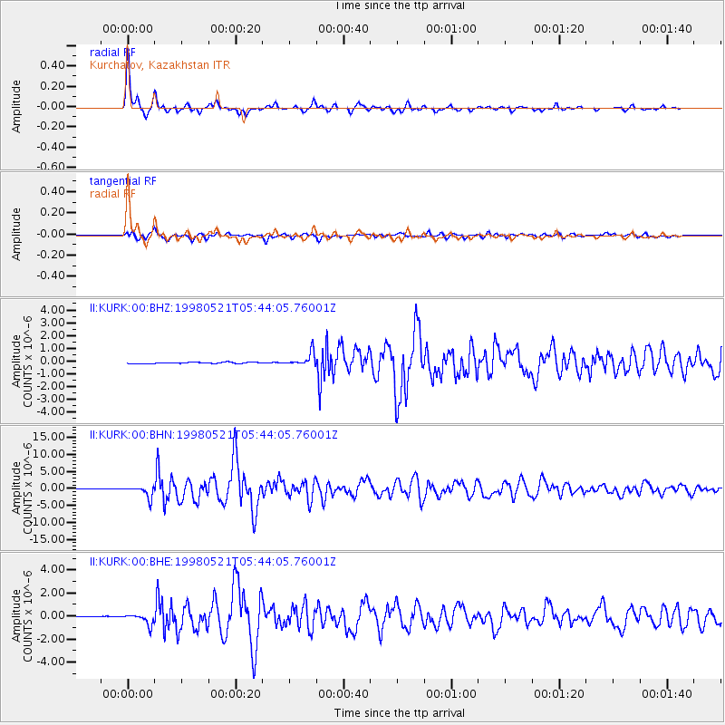
Signal To Noise
| Channel | StoN | STA | LTA |
| II:KURK:00:BHN:19980521T05:44:05.76001Z | 32.73619 | 1.7286404E-6 | 5.280518E-8 |
| II:KURK:00:BHE:19980521T05:44:05.76001Z | 2.9676425 | 4.4460268E-7 | 1.4981678E-7 |
| II:KURK:00:BHZ:19980521T05:44:05.76001Z | 10.326586 | 5.317118E-7 | 5.1489604E-8 |
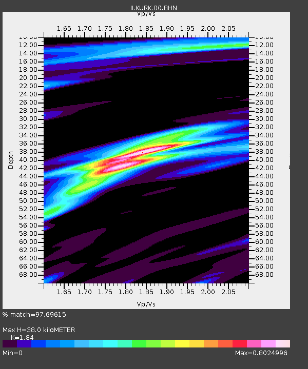
| Arrivals | |
| Ps | 5.1 SECOND |
| PpPs | 16 SECOND |
| PsPs/PpSs | 21 SECOND |

