You are here: Home > Network List > TA - USArray Transportable Network (new EarthScope stations) Stations List
> Station K48A Perry, MI, USA > Earthquake Result Viewer
K48A Perry, MI, USA - Earthquake Result Viewer
*The percent match for this event was below the threshold and hence no stack was calculated.
| Earthquake location: |
Near Coast Of Northern Chile |
| Earthquake latitude/longitude: |
-20.0/-70.9 |
| Earthquake time(UTC): |
2014/05/17 (137) 09:11:06 GMT |
| Earthquake Depth: |
13 km |
| Earthquake Magnitude: |
5.5 MB |
| Earthquake Catalog/Contributor: |
NEIC PDE/NEIC COMCAT |
|
| Network: |
TA USArray Transportable Network (new EarthScope stations) |
| Station: |
K48A Perry, MI, USA |
| Lat/Lon: |
42.80 N/84.12 W |
| Elevation: |
273 m |
|
| Distance: |
63.7 deg |
| Az: |
349.18 deg |
| Baz: |
166.122 deg |
| Ray Param: |
$rayparam |
*The percent match for this event was below the threshold and hence was not used in the summary stack. |
|
| Radial Match: |
53.80677 % |
| Radial Bump: |
400 |
| Transverse Match: |
51.822384 % |
| Transverse Bump: |
400 |
| SOD ConfigId: |
626651 |
| Insert Time: |
2014-05-31 09:49:31.987 +0000 |
| GWidth: |
2.5 |
| Max Bumps: |
400 |
| Tol: |
0.001 |
|
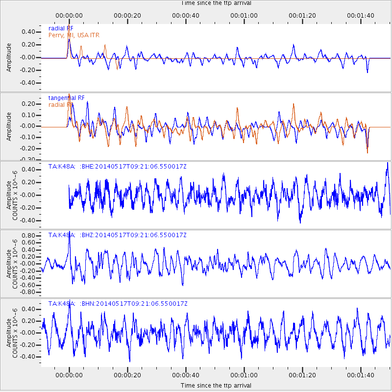
Signal To Noise
| Channel | StoN | STA | LTA |
| TA:K48A: :BHZ:20140517T09:21:06.550017Z | 3.4898818 | 3.52723E-7 | 1.01070185E-7 |
| TA:K48A: :BHN:20140517T09:21:06.550017Z | 1.4116745 | 2.3369488E-7 | 1.6554445E-7 |
| TA:K48A: :BHE:20140517T09:21:06.550017Z | 1.1215518 | 1.4727567E-7 | 1.3131421E-7 |
| Arrivals |
| Ps | |
| PpPs | |
| PsPs/PpSs | |


