You are here: Home > Network List > TA - USArray Transportable Network (new EarthScope stations) Stations List
> Station O03E Paynes Creek, CA, USA > Earthquake Result Viewer
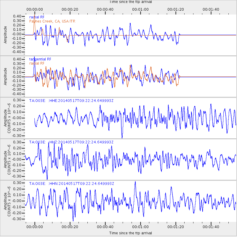
O03E Paynes Creek, CA, USA - Earthquake Result Viewer
*The percent match for this event was below the threshold and hence no stack was calculated.
| Earthquake location: |
Near Coast Of Northern Chile |
| Earthquake latitude/longitude: |
-20.0/-70.9 |
| Earthquake time(UTC): |
2014/05/17 (137) 09:11:06 GMT |
| Earthquake Depth: |
13 km |
| Earthquake Magnitude: |
5.5 MB |
| Earthquake Catalog/Contributor: |
NEIC PDE/NEIC COMCAT |
|
| Network: |
TA USArray Transportable Network (new EarthScope stations) |
| Station: |
O03E Paynes Creek, CA, USA |
| Lat/Lon: |
40.29 N/121.80 W |
| Elevation: |
967 m |
|
| Distance: |
76.4 deg |
| Az: |
322.368 deg |
| Baz: |
131.353 deg |
| Ray Param: |
$rayparam |
*The percent match for this event was below the threshold and hence was not used in the summary stack. |
|
| Radial Match: |
53.76453 % |
| Radial Bump: |
400 |
| Transverse Match: |
58.083214 % |
| Transverse Bump: |
400 |
| SOD ConfigId: |
626651 |
| Insert Time: |
2014-05-31 09:52:07.994 +0000 |
| GWidth: |
2.5 |
| Max Bumps: |
400 |
| Tol: |
0.001 |
|
Signal To Noise
| Channel | StoN | STA | LTA |
| TA:O03E: :HHZ:20140517T09:22:24.649993Z | 1.9781815 | 1.2279597E-7 | 6.207517E-8 |
| TA:O03E: :HHN:20140517T09:22:24.649993Z | 1.9389868 | 1.2450724E-7 | 6.421253E-8 |
| TA:O03E: :HHE:20140517T09:22:24.649993Z | 1.1836705 | 8.555574E-8 | 7.2280024E-8 |
| Arrivals |
| Ps | |
| PpPs | |
| PsPs/PpSs | |


