You are here: Home > Network List > TA - USArray Transportable Network (new EarthScope stations) Stations List
> Station O03E Paynes Creek, CA, USA > Earthquake Result Viewer
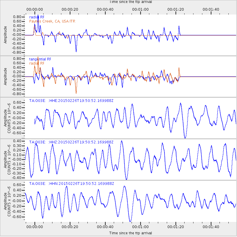
O03E Paynes Creek, CA, USA - Earthquake Result Viewer
*The percent match for this event was below the threshold and hence no stack was calculated.
| Earthquake location: |
South Of Fiji Islands |
| Earthquake latitude/longitude: |
-25.3/-176.4 |
| Earthquake time(UTC): |
2015/02/26 (057) 19:39:03 GMT |
| Earthquake Depth: |
35 km |
| Earthquake Magnitude: |
4.3 mb |
| Earthquake Catalog/Contributor: |
ISC/ISC |
|
| Network: |
TA USArray Transportable Network (new EarthScope stations) |
| Station: |
O03E Paynes Creek, CA, USA |
| Lat/Lon: |
40.29 N/121.80 W |
| Elevation: |
967 m |
|
| Distance: |
82.7 deg |
| Az: |
38.952 deg |
| Baz: |
228.057 deg |
| Ray Param: |
$rayparam |
*The percent match for this event was below the threshold and hence was not used in the summary stack. |
|
| Radial Match: |
66.70315 % |
| Radial Bump: |
400 |
| Transverse Match: |
41.88772 % |
| Transverse Bump: |
400 |
| SOD ConfigId: |
7019011 |
| Insert Time: |
2019-04-17 02:41:52.032 +0000 |
| GWidth: |
2.5 |
| Max Bumps: |
400 |
| Tol: |
0.001 |
|
Signal To Noise
| Channel | StoN | STA | LTA |
| TA:O03E: :HHZ:20150226T19:50:52.169988Z | 1.3247768 | 2.3530332E-7 | 1.7761734E-7 |
| TA:O03E: :HHN:20150226T19:50:52.169988Z | 1.4966248 | 3.1665127E-7 | 2.1157692E-7 |
| TA:O03E: :HHE:20150226T19:50:52.169988Z | 0.7080863 | 1.5212967E-7 | 2.1484624E-7 |
| Arrivals |
| Ps | |
| PpPs | |
| PsPs/PpSs | |


