You are here: Home > Network List > US - United States National Seismic Network Stations List
> Station MNTX Cornudas Mountains, Texas, USA > Earthquake Result Viewer
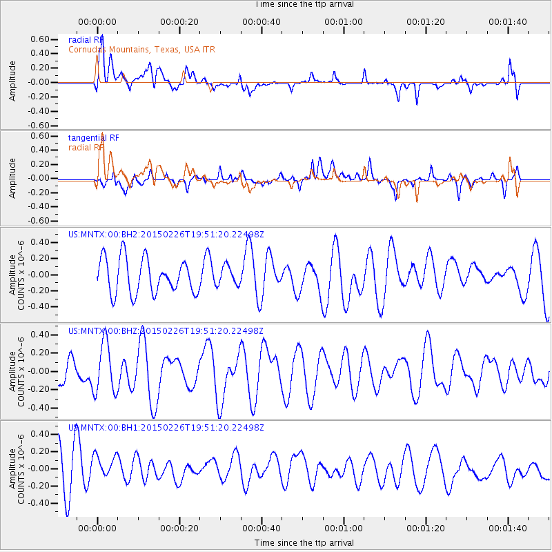
MNTX Cornudas Mountains, Texas, USA - Earthquake Result Viewer
*The percent match for this event was below the threshold and hence no stack was calculated.
| Earthquake location: |
South Of Fiji Islands |
| Earthquake latitude/longitude: |
-25.3/-176.4 |
| Earthquake time(UTC): |
2015/02/26 (057) 19:39:03 GMT |
| Earthquake Depth: |
35 km |
| Earthquake Magnitude: |
4.3 mb |
| Earthquake Catalog/Contributor: |
ISC/ISC |
|
| Network: |
US United States National Seismic Network |
| Station: |
MNTX Cornudas Mountains, Texas, USA |
| Lat/Lon: |
31.70 N/105.38 W |
| Elevation: |
404 m |
|
| Distance: |
88.4 deg |
| Az: |
53.751 deg |
| Baz: |
238.891 deg |
| Ray Param: |
$rayparam |
*The percent match for this event was below the threshold and hence was not used in the summary stack. |
|
| Radial Match: |
51.963795 % |
| Radial Bump: |
400 |
| Transverse Match: |
44.607258 % |
| Transverse Bump: |
400 |
| SOD ConfigId: |
7019011 |
| Insert Time: |
2019-04-17 02:42:23.212 +0000 |
| GWidth: |
2.5 |
| Max Bumps: |
400 |
| Tol: |
0.001 |
|
Signal To Noise
| Channel | StoN | STA | LTA |
| US:MNTX:00:BHZ:20150226T19:51:20.22498Z | 2.3296907 | 2.8001895E-7 | 1.2019576E-7 |
| US:MNTX:00:BH1:20150226T19:51:20.22498Z | 0.66803944 | 2.1352672E-7 | 3.196319E-7 |
| US:MNTX:00:BH2:20150226T19:51:20.22498Z | 0.5415726 | 1.1664682E-7 | 2.1538538E-7 |
| Arrivals |
| Ps | |
| PpPs | |
| PsPs/PpSs | |


