You are here: Home > Network List > US - United States National Seismic Network Stations List
> Station LAO LASA Array, Montana, USA > Earthquake Result Viewer
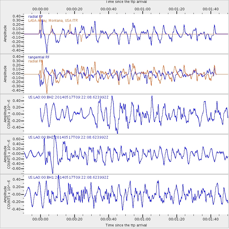
LAO LASA Array, Montana, USA - Earthquake Result Viewer
*The percent match for this event was below the threshold and hence no stack was calculated.
| Earthquake location: |
Near Coast Of Northern Chile |
| Earthquake latitude/longitude: |
-20.0/-70.9 |
| Earthquake time(UTC): |
2014/05/17 (137) 09:11:06 GMT |
| Earthquake Depth: |
13 km |
| Earthquake Magnitude: |
5.5 MB |
| Earthquake Catalog/Contributor: |
NEIC PDE/NEIC COMCAT |
|
| Network: |
US United States National Seismic Network |
| Station: |
LAO LASA Array, Montana, USA |
| Lat/Lon: |
46.69 N/106.22 W |
| Elevation: |
902 m |
|
| Distance: |
73.7 deg |
| Az: |
335.496 deg |
| Baz: |
145.49 deg |
| Ray Param: |
$rayparam |
*The percent match for this event was below the threshold and hence was not used in the summary stack. |
|
| Radial Match: |
63.498848 % |
| Radial Bump: |
400 |
| Transverse Match: |
51.57137 % |
| Transverse Bump: |
400 |
| SOD ConfigId: |
626651 |
| Insert Time: |
2014-05-31 09:57:23.977 +0000 |
| GWidth: |
2.5 |
| Max Bumps: |
400 |
| Tol: |
0.001 |
|
Signal To Noise
| Channel | StoN | STA | LTA |
| US:LAO:00:BHZ:20140517T09:22:08.623992Z | 2.7552316 | 2.3839428E-7 | 8.6524224E-8 |
| US:LAO:00:BH1:20140517T09:22:08.623992Z | 1.8167312 | 2.3212596E-7 | 1.2777122E-7 |
| US:LAO:00:BH2:20140517T09:22:08.623992Z | 1.4448398 | 2.3479971E-7 | 1.6250917E-7 |
| Arrivals |
| Ps | |
| PpPs | |
| PsPs/PpSs | |


