You are here: Home > Network List > TA - USArray Transportable Network (new EarthScope stations) Stations List
> Station A04D Lummi Island, WA, USA > Earthquake Result Viewer
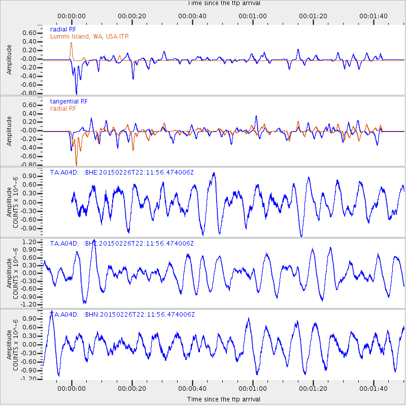
A04D Lummi Island, WA, USA - Earthquake Result Viewer
*The percent match for this event was below the threshold and hence no stack was calculated.
| Earthquake location: |
Pakistan |
| Earthquake latitude/longitude: |
34.7/73.2 |
| Earthquake time(UTC): |
2015/02/26 (057) 21:59:04 GMT |
| Earthquake Depth: |
30 km |
| Earthquake Magnitude: |
5.1 MW |
| Earthquake Catalog/Contributor: |
ISC/ISC |
|
| Network: |
TA USArray Transportable Network (new EarthScope stations) |
| Station: |
A04D Lummi Island, WA, USA |
| Lat/Lon: |
48.72 N/122.71 W |
| Elevation: |
13 m |
|
| Distance: |
95.7 deg |
| Az: |
10.537 deg |
| Baz: |
346.85 deg |
| Ray Param: |
$rayparam |
*The percent match for this event was below the threshold and hence was not used in the summary stack. |
|
| Radial Match: |
64.49935 % |
| Radial Bump: |
366 |
| Transverse Match: |
63.4293 % |
| Transverse Bump: |
400 |
| SOD ConfigId: |
7019011 |
| Insert Time: |
2019-04-17 02:47:05.927 +0000 |
| GWidth: |
2.5 |
| Max Bumps: |
400 |
| Tol: |
0.001 |
|
Signal To Noise
| Channel | StoN | STA | LTA |
| TA:A04D: :BHZ:20150226T22:11:56.474006Z | 2.1968546 | 6.5720747E-7 | 2.9915836E-7 |
| TA:A04D: :BHN:20150226T22:11:56.474006Z | 0.44432998 | 2.5516925E-7 | 5.742788E-7 |
| TA:A04D: :BHE:20150226T22:11:56.474006Z | 0.860474 | 3.2542104E-7 | 3.781881E-7 |
| Arrivals |
| Ps | |
| PpPs | |
| PsPs/PpSs | |


