You are here: Home > Network List > II - Global Seismograph Network (GSN - IRIS/IDA) Stations List
> Station PFO Pinon Flat, California, USA > Earthquake Result Viewer
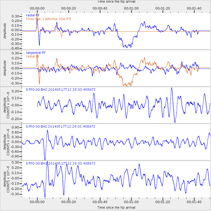
PFO Pinon Flat, California, USA - Earthquake Result Viewer
*The percent match for this event was below the threshold and hence no stack was calculated.
| Earthquake location: |
Pacific-Antarctic Ridge |
| Earthquake latitude/longitude: |
-54.3/-146.6 |
| Earthquake time(UTC): |
2014/05/17 (137) 12:13:29 GMT |
| Earthquake Depth: |
10 km |
| Earthquake Magnitude: |
5.9 MWP |
| Earthquake Catalog/Contributor: |
NEIC PDE/NEIC COMCAT |
|
| Network: |
II Global Seismograph Network (GSN - IRIS/IDA) |
| Station: |
PFO Pinon Flat, California, USA |
| Lat/Lon: |
33.61 N/116.46 W |
| Elevation: |
1280 m |
|
| Distance: |
91.4 deg |
| Az: |
24.767 deg |
| Baz: |
197.101 deg |
| Ray Param: |
$rayparam |
*The percent match for this event was below the threshold and hence was not used in the summary stack. |
|
| Radial Match: |
39.048462 % |
| Radial Bump: |
400 |
| Transverse Match: |
54.616837 % |
| Transverse Bump: |
400 |
| SOD ConfigId: |
626651 |
| Insert Time: |
2014-05-31 12:25:49.105 +0000 |
| GWidth: |
2.5 |
| Max Bumps: |
400 |
| Tol: |
0.001 |
|
Signal To Noise
| Channel | StoN | STA | LTA |
| II:PFO:00:BHZ:20140517T12:26:03.46897Z | 3.425964 | 3.2206214E-7 | 9.400628E-8 |
| II:PFO:00:BH1:20140517T12:26:03.46897Z | 1.093151 | 2.3344415E-7 | 2.1355162E-7 |
| II:PFO:00:BH2:20140517T12:26:03.46897Z | 0.92742735 | 5.101319E-8 | 5.500505E-8 |
| Arrivals |
| Ps | |
| PpPs | |
| PsPs/PpSs | |


