You are here: Home > Network List > UW - Pacific Northwest Regional Seismic Network Stations List
> Station MRBL Marblemount, WA, USA > Earthquake Result Viewer
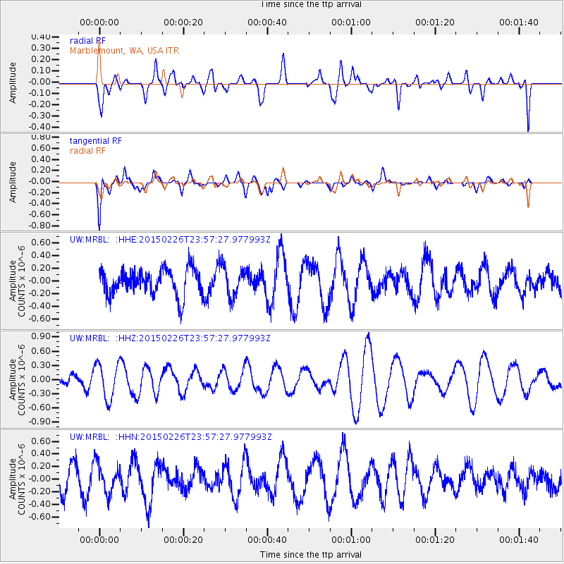
MRBL Marblemount, WA, USA - Earthquake Result Viewer
*The percent match for this event was below the threshold and hence no stack was calculated.
| Earthquake location: |
New Britain Region, P.N.G. |
| Earthquake latitude/longitude: |
-5.4/152.8 |
| Earthquake time(UTC): |
2015/02/26 (057) 23:44:58 GMT |
| Earthquake Depth: |
37 km |
| Earthquake Magnitude: |
5.0 MW |
| Earthquake Catalog/Contributor: |
ISC/ISC |
|
| Network: |
UW Pacific Northwest Regional Seismic Network |
| Station: |
MRBL Marblemount, WA, USA |
| Lat/Lon: |
48.52 N/121.48 W |
| Elevation: |
75 m |
|
| Distance: |
91.2 deg |
| Az: |
41.541 deg |
| Baz: |
263.226 deg |
| Ray Param: |
$rayparam |
*The percent match for this event was below the threshold and hence was not used in the summary stack. |
|
| Radial Match: |
42.530807 % |
| Radial Bump: |
400 |
| Transverse Match: |
54.86455 % |
| Transverse Bump: |
400 |
| SOD ConfigId: |
7019011 |
| Insert Time: |
2019-04-17 02:53:43.495 +0000 |
| GWidth: |
2.5 |
| Max Bumps: |
400 |
| Tol: |
0.001 |
|
Signal To Noise
| Channel | StoN | STA | LTA |
| UW:MRBL: :HHZ:20150226T23:57:27.977993Z | 2.4840467 | 3.8451734E-7 | 1.5479472E-7 |
| UW:MRBL: :HHN:20150226T23:57:27.977993Z | 1.2376944 | 2.2651737E-7 | 1.8301559E-7 |
| UW:MRBL: :HHE:20150226T23:57:27.977993Z | 1.1112267 | 2.2903482E-7 | 2.061099E-7 |
| Arrivals |
| Ps | |
| PpPs | |
| PsPs/PpSs | |


