You are here: Home > Network List > IU - Global Seismograph Network (GSN - IRIS/USGS) Stations List
> Station CTAO Charters Towers, Australia > Earthquake Result Viewer
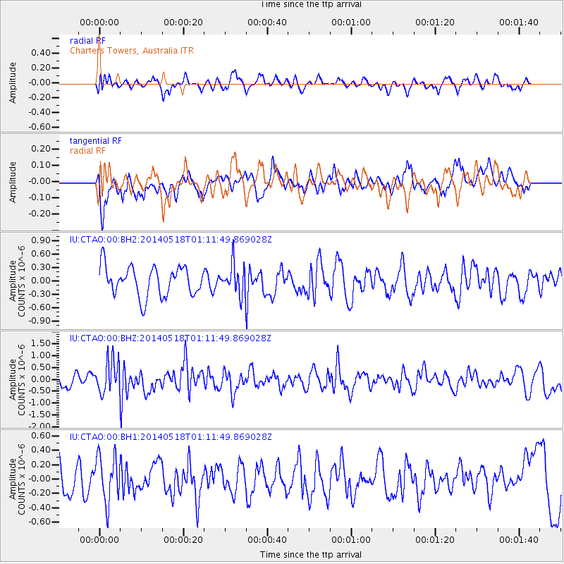
CTAO Charters Towers, Australia - Earthquake Result Viewer
*The percent match for this event was below the threshold and hence no stack was calculated.
| Earthquake location: |
Off W Coast Of Northern Sumatra |
| Earthquake latitude/longitude: |
4.3/92.7 |
| Earthquake time(UTC): |
2014/05/18 (138) 01:02:29 GMT |
| Earthquake Depth: |
9.8 km |
| Earthquake Magnitude: |
6.2 MWP |
| Earthquake Catalog/Contributor: |
NEIC PDE/NEIC COMCAT |
|
| Network: |
IU Global Seismograph Network (GSN - IRIS/USGS) |
| Station: |
CTAO Charters Towers, Australia |
| Lat/Lon: |
20.09 S/146.25 E |
| Elevation: |
357 m |
|
| Distance: |
57.8 deg |
| Az: |
116.803 deg |
| Baz: |
288.73 deg |
| Ray Param: |
$rayparam |
*The percent match for this event was below the threshold and hence was not used in the summary stack. |
|
| Radial Match: |
52.269997 % |
| Radial Bump: |
400 |
| Transverse Match: |
62.391026 % |
| Transverse Bump: |
400 |
| SOD ConfigId: |
626651 |
| Insert Time: |
2014-06-01 01:20:49.882 +0000 |
| GWidth: |
2.5 |
| Max Bumps: |
400 |
| Tol: |
0.001 |
|
Signal To Noise
| Channel | StoN | STA | LTA |
| IU:CTAO:00:BHZ:20140518T01:11:49.869028Z | 2.0822632 | 7.024357E-7 | 3.3734244E-7 |
| IU:CTAO:00:BH1:20140518T01:11:49.869028Z | 1.9932984 | 3.328796E-7 | 1.6699938E-7 |
| IU:CTAO:00:BH2:20140518T01:11:49.869028Z | 1.0244193 | 3.3841795E-7 | 3.30351E-7 |
| Arrivals |
| Ps | |
| PpPs | |
| PsPs/PpSs | |


