You are here: Home > Network List > UU - University of Utah Regional Network Stations List
> Station CCUT Cedar City, UT, USA > Earthquake Result Viewer
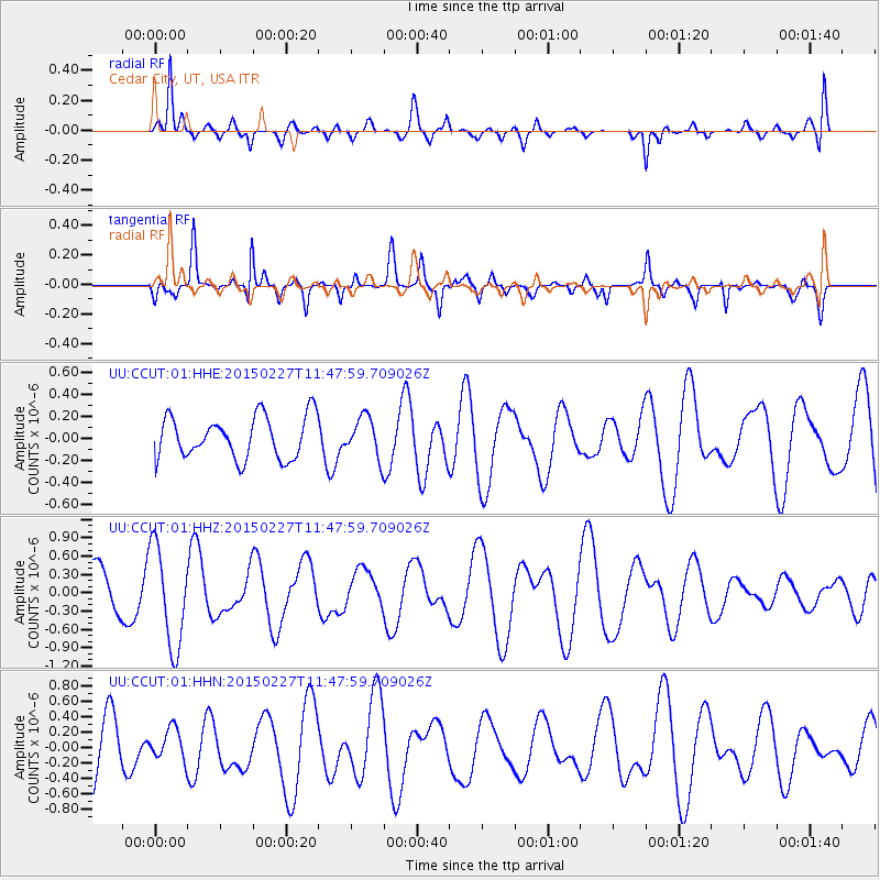
CCUT Cedar City, UT, USA - Earthquake Result Viewer
*The percent match for this event was below the threshold and hence no stack was calculated.
| Earthquake location: |
Solomon Islands |
| Earthquake latitude/longitude: |
-7.1/155.3 |
| Earthquake time(UTC): |
2015/02/27 (058) 11:35:15 GMT |
| Earthquake Depth: |
78 km |
| Earthquake Magnitude: |
5.4 MW |
| Earthquake Catalog/Contributor: |
ISC/ISC |
|
| Network: |
UU University of Utah Regional Network |
| Station: |
CCUT Cedar City, UT, USA |
| Lat/Lon: |
37.55 N/113.36 W |
| Elevation: |
2127 m |
|
| Distance: |
95.3 deg |
| Az: |
52.939 deg |
| Baz: |
265.189 deg |
| Ray Param: |
$rayparam |
*The percent match for this event was below the threshold and hence was not used in the summary stack. |
|
| Radial Match: |
76.85522 % |
| Radial Bump: |
385 |
| Transverse Match: |
72.80113 % |
| Transverse Bump: |
294 |
| SOD ConfigId: |
7019011 |
| Insert Time: |
2019-04-17 03:00:16.793 +0000 |
| GWidth: |
2.5 |
| Max Bumps: |
400 |
| Tol: |
0.001 |
|
Signal To Noise
| Channel | StoN | STA | LTA |
| UU:CCUT:01:HHZ:20150227T11:47:59.709026Z | 1.9904685 | 8.15611E-7 | 4.097583E-7 |
| UU:CCUT:01:HHN:20150227T11:47:59.709026Z | 0.6999499 | 2.0526143E-7 | 2.932516E-7 |
| UU:CCUT:01:HHE:20150227T11:47:59.709026Z | 0.9557664 | 1.8124845E-7 | 1.8963678E-7 |
| Arrivals |
| Ps | |
| PpPs | |
| PsPs/PpSs | |


