You are here: Home > Network List > UW - Pacific Northwest Regional Seismic Network Stations List
> Station MRBL Marblemount, WA, USA > Earthquake Result Viewer
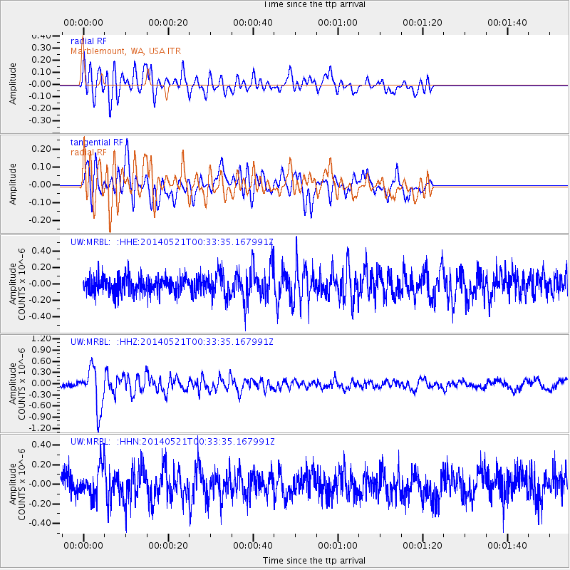
MRBL Marblemount, WA, USA - Earthquake Result Viewer
*The percent match for this event was below the threshold and hence no stack was calculated.
| Earthquake location: |
Taiwan |
| Earthquake latitude/longitude: |
23.7/121.5 |
| Earthquake time(UTC): |
2014/05/21 (141) 00:21:13 GMT |
| Earthquake Depth: |
12 km |
| Earthquake Magnitude: |
5.6 MB |
| Earthquake Catalog/Contributor: |
NEIC PDE/NEIC COMCAT |
|
| Network: |
UW Pacific Northwest Regional Seismic Network |
| Station: |
MRBL Marblemount, WA, USA |
| Lat/Lon: |
48.52 N/121.48 W |
| Elevation: |
75 m |
|
| Distance: |
88.7 deg |
| Az: |
36.321 deg |
| Baz: |
305.273 deg |
| Ray Param: |
$rayparam |
*The percent match for this event was below the threshold and hence was not used in the summary stack. |
|
| Radial Match: |
72.06716 % |
| Radial Bump: |
400 |
| Transverse Match: |
78.99752 % |
| Transverse Bump: |
400 |
| SOD ConfigId: |
626651 |
| Insert Time: |
2014-06-04 00:56:38.151 +0000 |
| GWidth: |
2.5 |
| Max Bumps: |
400 |
| Tol: |
0.001 |
|
Signal To Noise
| Channel | StoN | STA | LTA |
| UW:MRBL: :HHZ:20140521T00:33:35.167991Z | 10.414705 | 5.6051175E-7 | 5.3819264E-8 |
| UW:MRBL: :HHN:20140521T00:33:35.167991Z | 1.2164913 | 1.5037304E-7 | 1.236121E-7 |
| UW:MRBL: :HHE:20140521T00:33:35.167991Z | 1.4808255 | 1.4576078E-7 | 9.843211E-8 |
| Arrivals |
| Ps | |
| PpPs | |
| PsPs/PpSs | |


