You are here: Home > Network List > G - GEOSCOPE Stations List
> Station PPTF Pamatai - Papeete - Tahiti island - French Polynesia, France > Earthquake Result Viewer
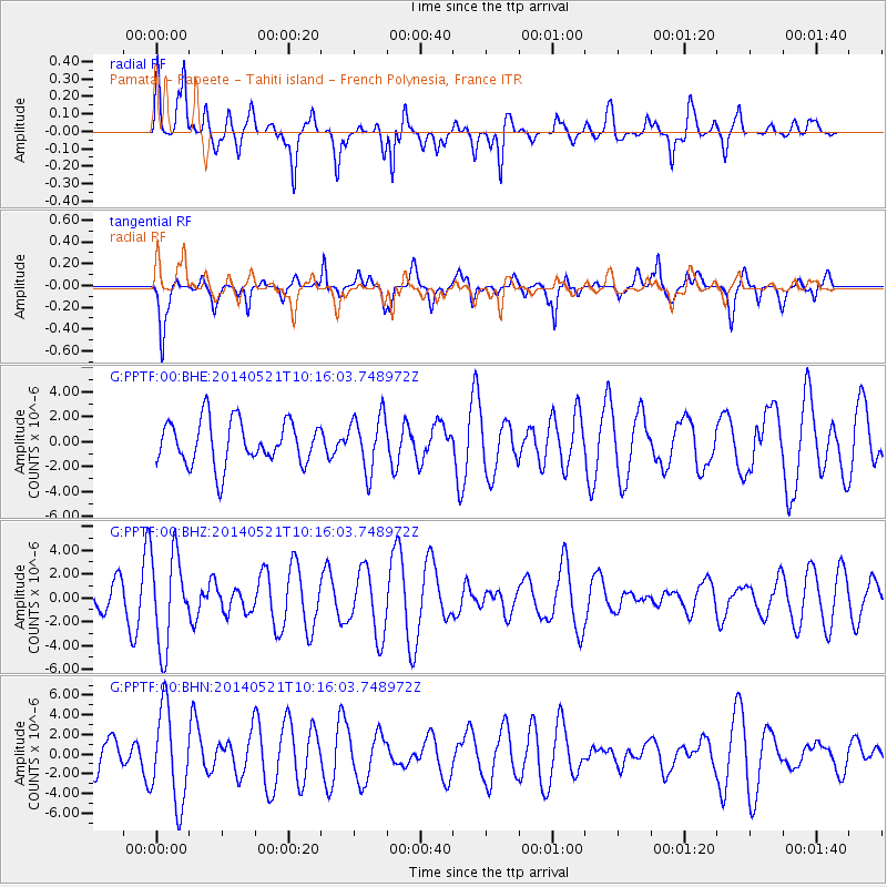
PPTF Pamatai - Papeete - Tahiti island - French Polynesia, France - Earthquake Result Viewer
*The percent match for this event was below the threshold and hence no stack was calculated.
| Earthquake location: |
Chiapas, Mexico |
| Earthquake latitude/longitude: |
17.2/-94.9 |
| Earthquake time(UTC): |
2014/05/21 (141) 10:06:14 GMT |
| Earthquake Depth: |
128 km |
| Earthquake Magnitude: |
5.6 MWP |
| Earthquake Catalog/Contributor: |
NEIC PDE/NEIC COMCAT |
|
| Network: |
G GEOSCOPE |
| Station: |
PPTF Pamatai - Papeete - Tahiti island - French Polynesia, France |
| Lat/Lon: |
17.59 S/149.57 W |
| Elevation: |
705 m |
|
| Distance: |
63.9 deg |
| Az: |
240.0 deg |
| Baz: |
60.217 deg |
| Ray Param: |
$rayparam |
*The percent match for this event was below the threshold and hence was not used in the summary stack. |
|
| Radial Match: |
57.947063 % |
| Radial Bump: |
400 |
| Transverse Match: |
66.14085 % |
| Transverse Bump: |
394 |
| SOD ConfigId: |
626651 |
| Insert Time: |
2014-06-04 10:32:05.485 +0000 |
| GWidth: |
2.5 |
| Max Bumps: |
400 |
| Tol: |
0.001 |
|
Signal To Noise
| Channel | StoN | STA | LTA |
| G:PPTF:00:BHZ:20140521T10:16:03.748972Z | 2.3157394 | 3.8317494E-6 | 1.654655E-6 |
| G:PPTF:00:BHN:20140521T10:16:03.748972Z | 2.751735 | 4.7440903E-6 | 1.724036E-6 |
| G:PPTF:00:BHE:20140521T10:16:03.748972Z | 1.2557074 | 2.21376E-6 | 1.7629585E-6 |
| Arrivals |
| Ps | |
| PpPs | |
| PsPs/PpSs | |


