You are here: Home > Network List > IU - Global Seismograph Network (GSN - IRIS/USGS) Stations List
> Station POHA Pohakuloa, Hawaii, USA > Earthquake Result Viewer
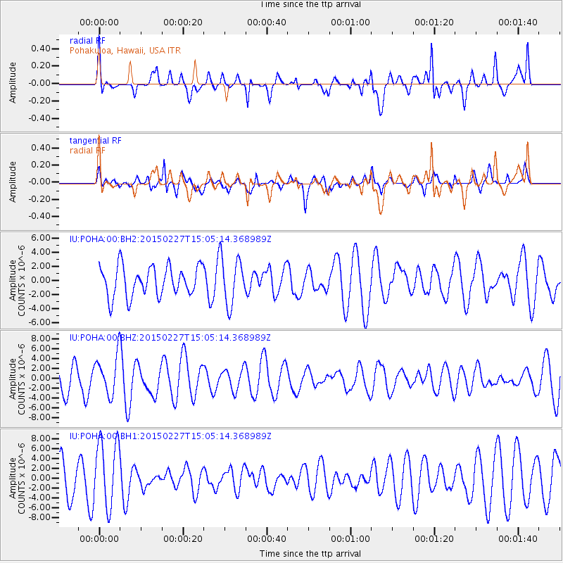
POHA Pohakuloa, Hawaii, USA - Earthquake Result Viewer
*The percent match for this event was below the threshold and hence no stack was calculated.
| Earthquake location: |
Mindanao, Philippines |
| Earthquake latitude/longitude: |
9.9/126.5 |
| Earthquake time(UTC): |
2015/02/27 (058) 14:54:07 GMT |
| Earthquake Depth: |
57 km |
| Earthquake Magnitude: |
4.9 mb |
| Earthquake Catalog/Contributor: |
ISC/ISC |
|
| Network: |
IU Global Seismograph Network (GSN - IRIS/USGS) |
| Station: |
POHA Pohakuloa, Hawaii, USA |
| Lat/Lon: |
19.76 N/155.53 W |
| Elevation: |
1990 m |
|
| Distance: |
75.4 deg |
| Az: |
72.109 deg |
| Baz: |
275.463 deg |
| Ray Param: |
$rayparam |
*The percent match for this event was below the threshold and hence was not used in the summary stack. |
|
| Radial Match: |
55.24556 % |
| Radial Bump: |
400 |
| Transverse Match: |
52.10134 % |
| Transverse Bump: |
400 |
| SOD ConfigId: |
7019011 |
| Insert Time: |
2019-04-17 03:10:37.155 +0000 |
| GWidth: |
2.5 |
| Max Bumps: |
400 |
| Tol: |
0.001 |
|
Signal To Noise
| Channel | StoN | STA | LTA |
| IU:POHA:00:BHZ:20150227T15:05:14.368989Z | 1.7026119 | 4.1522903E-6 | 2.4387768E-6 |
| IU:POHA:00:BH1:20150227T15:05:14.368989Z | 2.834172 | 6.8747636E-6 | 2.425669E-6 |
| IU:POHA:00:BH2:20150227T15:05:14.368989Z | 1.5276767 | 3.214685E-6 | 2.1042965E-6 |
| Arrivals |
| Ps | |
| PpPs | |
| PsPs/PpSs | |


