You are here: Home > Network List > TA - USArray Transportable Network (new EarthScope stations) Stations List
> Station G59A Clarenceville, QC, USA > Earthquake Result Viewer
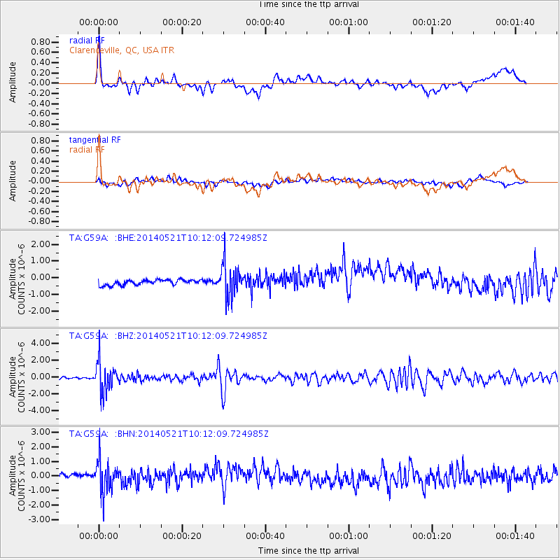
G59A Clarenceville, QC, USA - Earthquake Result Viewer
*The percent match for this event was below the threshold and hence no stack was calculated.
| Earthquake location: |
Chiapas, Mexico |
| Earthquake latitude/longitude: |
17.2/-94.9 |
| Earthquake time(UTC): |
2014/05/21 (141) 10:06:14 GMT |
| Earthquake Depth: |
128 km |
| Earthquake Magnitude: |
5.6 MWP |
| Earthquake Catalog/Contributor: |
NEIC PDE/NEIC COMCAT |
|
| Network: |
TA USArray Transportable Network (new EarthScope stations) |
| Station: |
G59A Clarenceville, QC, USA |
| Lat/Lon: |
45.08 N/73.18 W |
| Elevation: |
36 m |
|
| Distance: |
33.2 deg |
| Az: |
28.591 deg |
| Baz: |
220.217 deg |
| Ray Param: |
$rayparam |
*The percent match for this event was below the threshold and hence was not used in the summary stack. |
|
| Radial Match: |
49.78583 % |
| Radial Bump: |
400 |
| Transverse Match: |
34.45144 % |
| Transverse Bump: |
400 |
| SOD ConfigId: |
626651 |
| Insert Time: |
2014-06-04 10:46:52.027 +0000 |
| GWidth: |
2.5 |
| Max Bumps: |
400 |
| Tol: |
0.001 |
|
Signal To Noise
| Channel | StoN | STA | LTA |
| TA:G59A: :BHZ:20140521T10:12:09.724985Z | 14.017682 | 1.821895E-6 | 1.2997121E-7 |
| TA:G59A: :BHN:20140521T10:12:09.724985Z | 2.3653955 | 1.1681004E-6 | 4.9382874E-7 |
| TA:G59A: :BHE:20140521T10:12:09.724985Z | 6.4412775 | 9.98688E-7 | 1.5504503E-7 |
| Arrivals |
| Ps | |
| PpPs | |
| PsPs/PpSs | |


