You are here: Home > Network List > PF - Volcanologic Network of Piton de Fournaise-OVPF Stations List
> Station HIM cratere Himiltrude > Earthquake Result Viewer
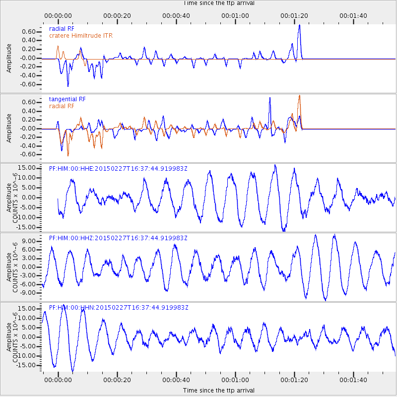
HIM cratere Himiltrude - Earthquake Result Viewer
*The percent match for this event was below the threshold and hence no stack was calculated.
| Earthquake location: |
Mariana Islands |
| Earthquake latitude/longitude: |
16.9/145.8 |
| Earthquake time(UTC): |
2015/02/27 (058) 16:24:50 GMT |
| Earthquake Depth: |
20 km |
| Earthquake Magnitude: |
5.7 MB |
| Earthquake Catalog/Contributor: |
NEIC PDE/NEIC ALERT |
|
| Network: |
PF Volcanologic Network of Piton de Fournaise-OVPF |
| Station: |
HIM cratere Himiltrude |
| Lat/Lon: |
21.21 S/55.72 E |
| Elevation: |
1958 m |
|
| Distance: |
96.1 deg |
| Az: |
249.775 deg |
| Baz: |
74.296 deg |
| Ray Param: |
$rayparam |
*The percent match for this event was below the threshold and hence was not used in the summary stack. |
|
| Radial Match: |
48.579727 % |
| Radial Bump: |
400 |
| Transverse Match: |
72.38768 % |
| Transverse Bump: |
400 |
| SOD ConfigId: |
7019011 |
| Insert Time: |
2019-04-17 03:17:50.228 +0000 |
| GWidth: |
2.5 |
| Max Bumps: |
400 |
| Tol: |
0.001 |
|
Signal To Noise
| Channel | StoN | STA | LTA |
| PF:HIM:00:HHZ:20150227T16:37:44.919983Z | 0.95471406 | 4.3010173E-6 | 4.505032E-6 |
| PF:HIM:00:HHN:20150227T16:37:44.919983Z | 2.0483751 | 1.2007993E-5 | 5.862204E-6 |
| PF:HIM:00:HHE:20150227T16:37:44.919983Z | 1.349538 | 5.557866E-6 | 4.1183475E-6 |
| Arrivals |
| Ps | |
| PpPs | |
| PsPs/PpSs | |


