KURK Kurchatov, Kazakhstan - Earthquake Result Viewer
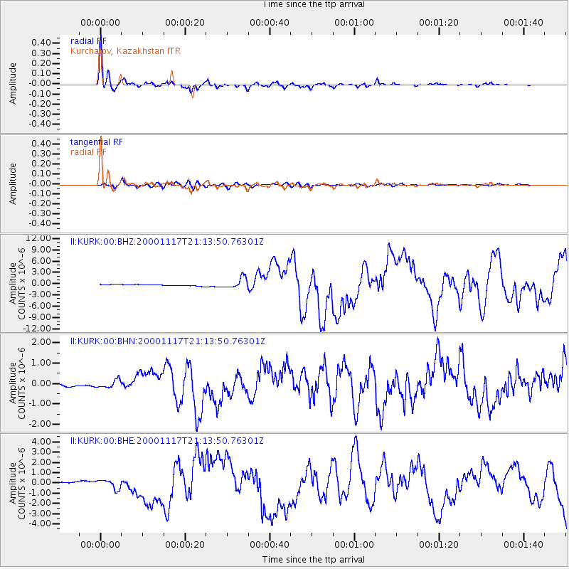
Earthquake location: New Britain Region, P.N.G.
Earthquake latitude/longitude: -5.5/151.8
Earthquake time(UTC): 2000/11/17 (322) 21:01:56 GMT
Earthquake Depth: 33 km
Earthquake Magnitude: 6.2 MB, 8.0 MS, 7.6 MW, 6.9 ME
Earthquake Catalog/Contributor: WHDF/NEIC
Network: II Global Seismograph Network (GSN - IRIS/IDA)
Station: KURK Kurchatov, Kazakhstan
Lat/Lon: 50.72 N/78.62 E
Elevation: 184 m
Distance: 83.7 deg
Az: 322.254 deg
Baz: 106.547 deg
Ray Param: 0.04596357
Estimated Moho Depth: 34.5 km
Estimated Crust Vp/Vs: 2.07
Assumed Crust Vp: 6.552 km/s
Estimated Crust Vs: 3.162 km/s
Estimated Crust Poisson's Ratio: 0.35
Radial Match: 97.81248 %
Radial Bump: 341
Transverse Match: 86.518036 %
Transverse Bump: 400
SOD ConfigId: 3744
Insert Time: 2010-03-01 22:29:12.314 +0000
GWidth: 2.5
Max Bumps: 400
Tol: 0.001

Signal To Noise

ChannelStoNSTALTA
II:KURK:00:BHN:20001117T21:13:50.76301Z2.88585521.9373236E-76.71317E-8
II:KURK:00:BHE:20001117T21:13:50.76301Z4.80730964.573172E-79.512955E-8
II:KURK:00:BHZ:20001117T21:13:50.76301Z8.3540981.4949856E-61.7895236E-7
Arrivals
Ps5.8 SECOND
PpPs16 SECOND
PsPs/PpSs22 SECOND