You are here: Home > Network List > TA - USArray Transportable Network (new EarthScope stations) Stations List
> Station M61A Granite Springs, NY, USA > Earthquake Result Viewer
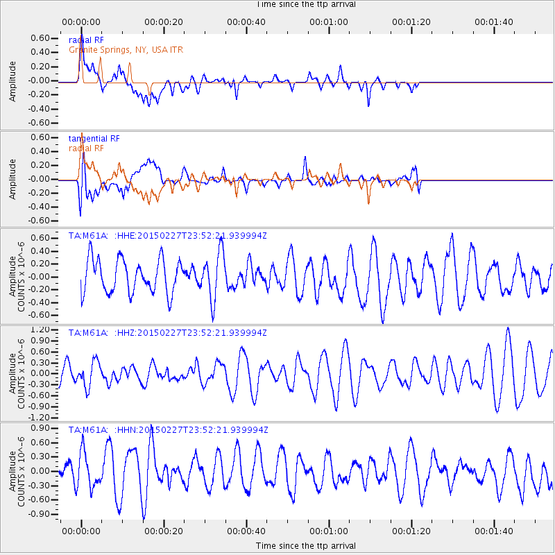
M61A Granite Springs, NY, USA - Earthquake Result Viewer
*The percent match for this event was below the threshold and hence no stack was calculated.
| Earthquake location: |
Guatemala |
| Earthquake latitude/longitude: |
14.0/-90.9 |
| Earthquake time(UTC): |
2015/02/27 (058) 23:46:42 GMT |
| Earthquake Depth: |
83 km |
| Earthquake Magnitude: |
5.0 MW |
| Earthquake Catalog/Contributor: |
ISC/ISC |
|
| Network: |
TA USArray Transportable Network (new EarthScope stations) |
| Station: |
M61A Granite Springs, NY, USA |
| Lat/Lon: |
41.31 N/73.77 W |
| Elevation: |
190 m |
|
| Distance: |
31.0 deg |
| Az: |
25.569 deg |
| Baz: |
213.78 deg |
| Ray Param: |
$rayparam |
*The percent match for this event was below the threshold and hence was not used in the summary stack. |
|
| Radial Match: |
54.167942 % |
| Radial Bump: |
400 |
| Transverse Match: |
40.051662 % |
| Transverse Bump: |
400 |
| SOD ConfigId: |
7019011 |
| Insert Time: |
2019-04-17 03:27:03.196 +0000 |
| GWidth: |
2.5 |
| Max Bumps: |
400 |
| Tol: |
0.001 |
|
Signal To Noise
| Channel | StoN | STA | LTA |
| TA:M61A: :HHZ:20150227T23:52:21.939994Z | 2.4686682 | 3.484111E-7 | 1.4113323E-7 |
| TA:M61A: :HHN:20150227T23:52:21.939994Z | 1.4488518 | 4.2080407E-7 | 2.904397E-7 |
| TA:M61A: :HHE:20150227T23:52:21.939994Z | 1.4331323 | 3.7223734E-7 | 2.597369E-7 |
| Arrivals |
| Ps | |
| PpPs | |
| PsPs/PpSs | |


