You are here: Home > Network List > GS - US Geological Survey Networks Stations List
> Station KAN10 Keim Farm > Earthquake Result Viewer
KAN10 Keim Farm - Earthquake Result Viewer
*The percent match for this event was below the threshold and hence no stack was calculated.
| Earthquake location: |
Hokkaido, Japan Region |
| Earthquake latitude/longitude: |
42.8/144.4 |
| Earthquake time(UTC): |
2015/02/28 (059) 00:40:43 GMT |
| Earthquake Depth: |
100 km |
| Earthquake Magnitude: |
4.6 mb |
| Earthquake Catalog/Contributor: |
ISC/ISC |
|
| Network: |
GS US Geological Survey Networks |
| Station: |
KAN10 Keim Farm |
| Lat/Lon: |
37.12 N/98.10 W |
| Elevation: |
417 m |
|
| Distance: |
82.3 deg |
| Az: |
45.657 deg |
| Baz: |
318.778 deg |
| Ray Param: |
$rayparam |
*The percent match for this event was below the threshold and hence was not used in the summary stack. |
|
| Radial Match: |
39.015415 % |
| Radial Bump: |
400 |
| Transverse Match: |
46.819267 % |
| Transverse Bump: |
400 |
| SOD ConfigId: |
7019011 |
| Insert Time: |
2019-04-17 03:32:07.734 +0000 |
| GWidth: |
2.5 |
| Max Bumps: |
400 |
| Tol: |
0.001 |
|
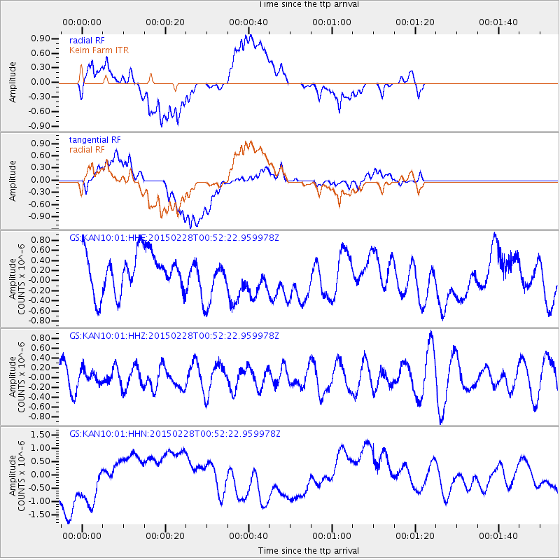
Signal To Noise
| Channel | StoN | STA | LTA |
| GS:KAN10:01:HHZ:20150228T00:52:22.959978Z | 0.48877007 | 1.3793932E-7 | 2.822172E-7 |
| GS:KAN10:01:HHN:20150228T00:52:22.959978Z | 1.7095314 | 9.016649E-7 | 5.2743394E-7 |
| GS:KAN10:01:HHE:20150228T00:52:22.959978Z | 1.1984799 | 4.7100312E-7 | 3.9300045E-7 |
| Arrivals |
| Ps | |
| PpPs | |
| PsPs/PpSs | |


