You are here: Home > Network List > TA - USArray Transportable Network (new EarthScope stations) Stations List
> Station L04D Klamath Falls, OR, USA > Earthquake Result Viewer
L04D Klamath Falls, OR, USA - Earthquake Result Viewer
*The percent match for this event was below the threshold and hence no stack was calculated.
| Earthquake location: |
Hokkaido, Japan Region |
| Earthquake latitude/longitude: |
42.8/144.4 |
| Earthquake time(UTC): |
2015/02/28 (059) 00:40:43 GMT |
| Earthquake Depth: |
100 km |
| Earthquake Magnitude: |
4.6 mb |
| Earthquake Catalog/Contributor: |
ISC/ISC |
|
| Network: |
TA USArray Transportable Network (new EarthScope stations) |
| Station: |
L04D Klamath Falls, OR, USA |
| Lat/Lon: |
42.22 N/122.30 W |
| Elevation: |
1437 m |
|
| Distance: |
65.1 deg |
| Az: |
54.844 deg |
| Baz: |
305.846 deg |
| Ray Param: |
$rayparam |
*The percent match for this event was below the threshold and hence was not used in the summary stack. |
|
| Radial Match: |
59.88459 % |
| Radial Bump: |
400 |
| Transverse Match: |
37.37669 % |
| Transverse Bump: |
344 |
| SOD ConfigId: |
7019011 |
| Insert Time: |
2019-04-17 03:35:44.058 +0000 |
| GWidth: |
2.5 |
| Max Bumps: |
400 |
| Tol: |
0.001 |
|
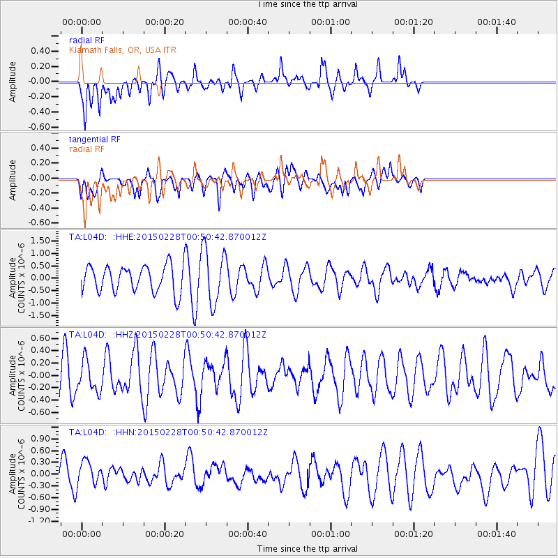
Signal To Noise
| Channel | StoN | STA | LTA |
| TA:L04D: :HHZ:20150228T00:50:42.870012Z | 0.5963956 | 2.5192222E-7 | 4.2240794E-7 |
| TA:L04D: :HHN:20150228T00:50:42.870012Z | 0.6076831 | 3.1849257E-7 | 5.241096E-7 |
| TA:L04D: :HHE:20150228T00:50:42.870012Z | 2.124288 | 1.1305706E-6 | 5.322115E-7 |
| Arrivals |
| Ps | |
| PpPs | |
| PsPs/PpSs | |


