You are here: Home > Network List > TA - USArray Transportable Network (new EarthScope stations) Stations List
> Station N23A Red Feather Lakes, CO, USA > Earthquake Result Viewer
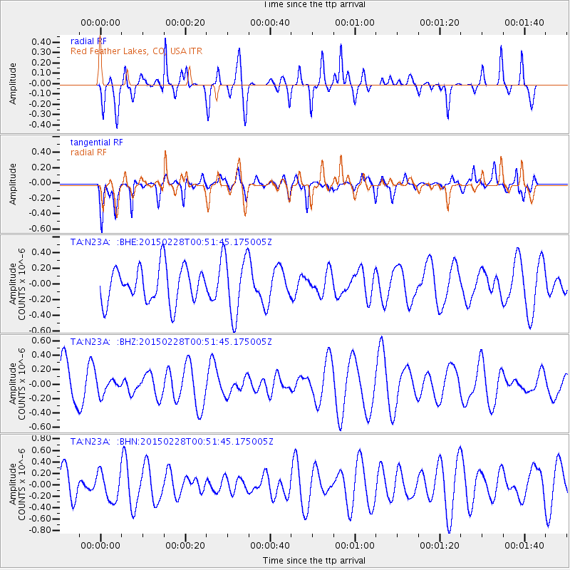
N23A Red Feather Lakes, CO, USA - Earthquake Result Viewer
*The percent match for this event was below the threshold and hence no stack was calculated.
| Earthquake location: |
Hokkaido, Japan Region |
| Earthquake latitude/longitude: |
42.8/144.4 |
| Earthquake time(UTC): |
2015/02/28 (059) 00:40:43 GMT |
| Earthquake Depth: |
100 km |
| Earthquake Magnitude: |
4.6 mb |
| Earthquake Catalog/Contributor: |
ISC/ISC |
|
| Network: |
TA USArray Transportable Network (new EarthScope stations) |
| Station: |
N23A Red Feather Lakes, CO, USA |
| Lat/Lon: |
40.89 N/105.94 W |
| Elevation: |
2458 m |
|
| Distance: |
75.3 deg |
| Az: |
47.539 deg |
| Baz: |
314.216 deg |
| Ray Param: |
$rayparam |
*The percent match for this event was below the threshold and hence was not used in the summary stack. |
|
| Radial Match: |
58.164124 % |
| Radial Bump: |
369 |
| Transverse Match: |
53.450832 % |
| Transverse Bump: |
400 |
| SOD ConfigId: |
7019011 |
| Insert Time: |
2019-04-17 03:35:51.529 +0000 |
| GWidth: |
2.5 |
| Max Bumps: |
400 |
| Tol: |
0.001 |
|
Signal To Noise
| Channel | StoN | STA | LTA |
| TA:N23A: :BHZ:20150228T00:51:45.175005Z | 0.44755372 | 1.0209001E-7 | 2.2810671E-7 |
| TA:N23A: :BHN:20150228T00:51:45.175005Z | 0.65153027 | 2.4977777E-7 | 3.8337095E-7 |
| TA:N23A: :BHE:20150228T00:51:45.175005Z | 1.7281832 | 3.922098E-7 | 2.2694921E-7 |
| Arrivals |
| Ps | |
| PpPs | |
| PsPs/PpSs | |


