You are here: Home > Network List > UW - Pacific Northwest Regional Seismic Network Stations List
> Station MRBL Marblemount, WA, USA > Earthquake Result Viewer
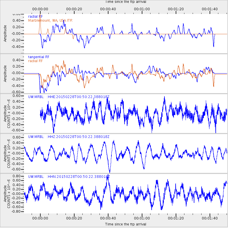
MRBL Marblemount, WA, USA - Earthquake Result Viewer
*The percent match for this event was below the threshold and hence no stack was calculated.
| Earthquake location: |
Hokkaido, Japan Region |
| Earthquake latitude/longitude: |
42.8/144.4 |
| Earthquake time(UTC): |
2015/02/28 (059) 00:40:43 GMT |
| Earthquake Depth: |
100 km |
| Earthquake Magnitude: |
4.6 mb |
| Earthquake Catalog/Contributor: |
ISC/ISC |
|
| Network: |
UW Pacific Northwest Regional Seismic Network |
| Station: |
MRBL Marblemount, WA, USA |
| Lat/Lon: |
48.52 N/121.48 W |
| Elevation: |
75 m |
|
| Distance: |
62.0 deg |
| Az: |
48.694 deg |
| Baz: |
303.685 deg |
| Ray Param: |
$rayparam |
*The percent match for this event was below the threshold and hence was not used in the summary stack. |
|
| Radial Match: |
53.956112 % |
| Radial Bump: |
400 |
| Transverse Match: |
55.013 % |
| Transverse Bump: |
400 |
| SOD ConfigId: |
7019011 |
| Insert Time: |
2019-04-17 03:36:54.311 +0000 |
| GWidth: |
2.5 |
| Max Bumps: |
400 |
| Tol: |
0.001 |
|
Signal To Noise
| Channel | StoN | STA | LTA |
| UW:MRBL: :HHZ:20150228T00:50:22.388018Z | 0.99890614 | 1.8324386E-7 | 1.8344453E-7 |
| UW:MRBL: :HHN:20150228T00:50:22.388018Z | 1.4622552 | 2.9235244E-7 | 1.9993256E-7 |
| UW:MRBL: :HHE:20150228T00:50:22.388018Z | 1.1757345 | 2.1701254E-7 | 1.8457615E-7 |
| Arrivals |
| Ps | |
| PpPs | |
| PsPs/PpSs | |


