You are here: Home > Network List > UW - Pacific Northwest Regional Seismic Network Stations List
> Station UMAT Pilot Rock, OR, USA > Earthquake Result Viewer
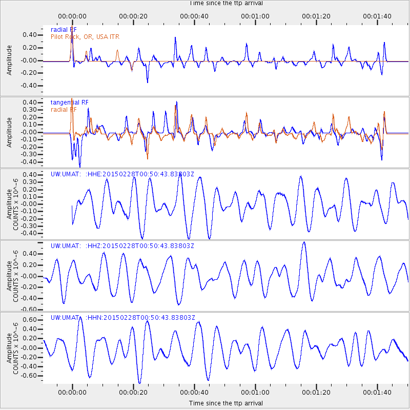
UMAT Pilot Rock, OR, USA - Earthquake Result Viewer
*The percent match for this event was below the threshold and hence no stack was calculated.
| Earthquake location: |
Hokkaido, Japan Region |
| Earthquake latitude/longitude: |
42.8/144.4 |
| Earthquake time(UTC): |
2015/02/28 (059) 00:40:43 GMT |
| Earthquake Depth: |
100 km |
| Earthquake Magnitude: |
4.6 mb |
| Earthquake Catalog/Contributor: |
ISC/ISC |
|
| Network: |
UW Pacific Northwest Regional Seismic Network |
| Station: |
UMAT Pilot Rock, OR, USA |
| Lat/Lon: |
45.29 N/118.96 W |
| Elevation: |
1318 m |
|
| Distance: |
65.2 deg |
| Az: |
50.537 deg |
| Baz: |
306.343 deg |
| Ray Param: |
$rayparam |
*The percent match for this event was below the threshold and hence was not used in the summary stack. |
|
| Radial Match: |
49.245716 % |
| Radial Bump: |
370 |
| Transverse Match: |
72.179924 % |
| Transverse Bump: |
400 |
| SOD ConfigId: |
7019011 |
| Insert Time: |
2019-04-17 03:36:57.008 +0000 |
| GWidth: |
2.5 |
| Max Bumps: |
400 |
| Tol: |
0.001 |
|
Signal To Noise
| Channel | StoN | STA | LTA |
| UW:UMAT: :HHZ:20150228T00:50:43.83803Z | 0.82907015 | 1.5761684E-7 | 1.9011279E-7 |
| UW:UMAT: :HHN:20150228T00:50:43.83803Z | 3.0406823 | 4.131666E-7 | 1.3587956E-7 |
| UW:UMAT: :HHE:20150228T00:50:43.83803Z | 0.53216624 | 1.0692287E-7 | 2.0092006E-7 |
| Arrivals |
| Ps | |
| PpPs | |
| PsPs/PpSs | |


