You are here: Home > Network List > TA - USArray Transportable Network (new EarthScope stations) Stations List
> Station A21K Barrow, AK, USA > Earthquake Result Viewer
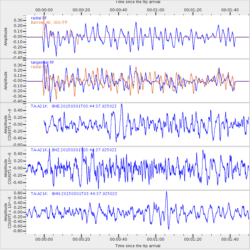
A21K Barrow, AK, USA - Earthquake Result Viewer
*The percent match for this event was below the threshold and hence no stack was calculated.
| Earthquake location: |
Minahassa Peninsula, Sulawesi |
| Earthquake latitude/longitude: |
0.0/124.4 |
| Earthquake time(UTC): |
2015/03/01 (060) 03:32:36 GMT |
| Earthquake Depth: |
90 km |
| Earthquake Magnitude: |
5.6 MW |
| Earthquake Catalog/Contributor: |
ISC/ISC |
|
| Network: |
TA USArray Transportable Network (new EarthScope stations) |
| Station: |
A21K Barrow, AK, USA |
| Lat/Lon: |
71.32 N/156.62 W |
| Elevation: |
577 m |
|
| Distance: |
86.4 deg |
| Az: |
18.472 deg |
| Baz: |
259.555 deg |
| Ray Param: |
$rayparam |
*The percent match for this event was below the threshold and hence was not used in the summary stack. |
|
| Radial Match: |
52.93224 % |
| Radial Bump: |
400 |
| Transverse Match: |
65.13089 % |
| Transverse Bump: |
400 |
| SOD ConfigId: |
7019011 |
| Insert Time: |
2019-04-17 03:41:31.149 +0000 |
| GWidth: |
2.5 |
| Max Bumps: |
400 |
| Tol: |
0.001 |
|
Signal To Noise
| Channel | StoN | STA | LTA |
| TA:A21K: :BHZ:20150301T03:44:37.92502Z | 2.4494252 | 1.9812325E-7 | 8.088561E-8 |
| TA:A21K: :BHN:20150301T03:44:37.92502Z | 1.2112677 | 1.6901123E-7 | 1.3953253E-7 |
| TA:A21K: :BHE:20150301T03:44:37.92502Z | 1.0970052 | 1.3685778E-7 | 1.247558E-7 |
| Arrivals |
| Ps | |
| PpPs | |
| PsPs/PpSs | |


