You are here: Home > Network List > TA - USArray Transportable Network (new EarthScope stations) Stations List
> Station H47A Mio, MI, USA > Earthquake Result Viewer
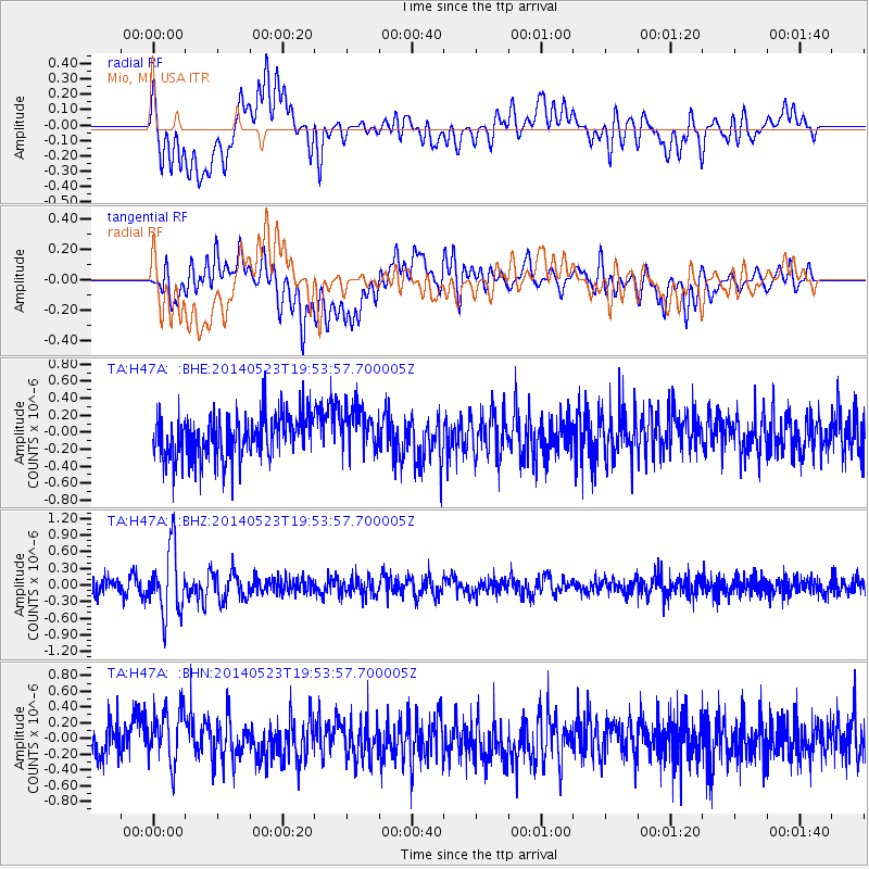
H47A Mio, MI, USA - Earthquake Result Viewer
*The percent match for this event was below the threshold and hence no stack was calculated.
| Earthquake location: |
East Of Lake Baykal, Russia |
| Earthquake latitude/longitude: |
56.1/114.0 |
| Earthquake time(UTC): |
2014/05/23 (143) 19:42:28 GMT |
| Earthquake Depth: |
10 km |
| Earthquake Magnitude: |
5.6 MB |
| Earthquake Catalog/Contributor: |
NEIC PDE/NEIC COMCAT |
|
| Network: |
TA USArray Transportable Network (new EarthScope stations) |
| Station: |
H47A Mio, MI, USA |
| Lat/Lon: |
44.60 N/84.21 W |
| Elevation: |
356 m |
|
| Distance: |
78.5 deg |
| Az: |
13.163 deg |
| Baz: |
349.722 deg |
| Ray Param: |
$rayparam |
*The percent match for this event was below the threshold and hence was not used in the summary stack. |
|
| Radial Match: |
55.331585 % |
| Radial Bump: |
400 |
| Transverse Match: |
38.833393 % |
| Transverse Bump: |
400 |
| SOD ConfigId: |
626651 |
| Insert Time: |
2014-06-06 20:43:31.418 +0000 |
| GWidth: |
2.5 |
| Max Bumps: |
400 |
| Tol: |
0.001 |
|
Signal To Noise
| Channel | StoN | STA | LTA |
| TA:H47A: :BHZ:20140523T19:53:57.700005Z | 3.8425124 | 5.9478714E-7 | 1.5479121E-7 |
| TA:H47A: :BHN:20140523T19:53:57.700005Z | 1.5202769 | 3.502635E-7 | 2.3039453E-7 |
| TA:H47A: :BHE:20140523T19:53:57.700005Z | 1.054352 | 2.7231445E-7 | 2.582766E-7 |
| Arrivals |
| Ps | |
| PpPs | |
| PsPs/PpSs | |


