You are here: Home > Network List > TA - USArray Transportable Network (new EarthScope stations) Stations List
> Station MSTX Muleshoe, TX, USA > Earthquake Result Viewer
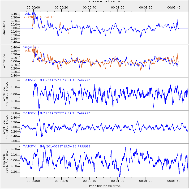
MSTX Muleshoe, TX, USA - Earthquake Result Viewer
*The percent match for this event was below the threshold and hence no stack was calculated.
| Earthquake location: |
East Of Lake Baykal, Russia |
| Earthquake latitude/longitude: |
56.1/114.0 |
| Earthquake time(UTC): |
2014/05/23 (143) 19:42:28 GMT |
| Earthquake Depth: |
10 km |
| Earthquake Magnitude: |
5.6 MB |
| Earthquake Catalog/Contributor: |
NEIC PDE/NEIC COMCAT |
|
| Network: |
TA USArray Transportable Network (new EarthScope stations) |
| Station: |
MSTX Muleshoe, TX, USA |
| Lat/Lon: |
33.97 N/102.77 W |
| Elevation: |
1167 m |
|
| Distance: |
84.9 deg |
| Az: |
29.959 deg |
| Baz: |
340.347 deg |
| Ray Param: |
$rayparam |
*The percent match for this event was below the threshold and hence was not used in the summary stack. |
|
| Radial Match: |
61.566704 % |
| Radial Bump: |
400 |
| Transverse Match: |
52.736187 % |
| Transverse Bump: |
400 |
| SOD ConfigId: |
626651 |
| Insert Time: |
2014-06-06 20:50:17.019 +0000 |
| GWidth: |
2.5 |
| Max Bumps: |
400 |
| Tol: |
0.001 |
|
Signal To Noise
| Channel | StoN | STA | LTA |
| TA:MSTX: :BHZ:20140523T19:54:31.749993Z | 3.239185 | 2.5764882E-7 | 7.954125E-8 |
| TA:MSTX: :BHN:20140523T19:54:31.749993Z | 1.8815205 | 1.1609053E-7 | 6.170038E-8 |
| TA:MSTX: :BHE:20140523T19:54:31.749993Z | 0.81618977 | 6.517597E-8 | 7.985394E-8 |
| Arrivals |
| Ps | |
| PpPs | |
| PsPs/PpSs | |


