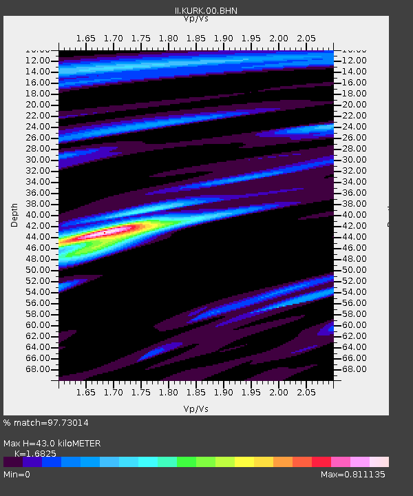
KURK Kurchatov, Kazakhstan - Earthquake Result Viewer
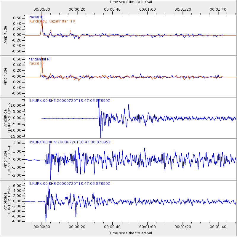
Earthquake location: Near East Coast Of Honshu, Japan
Earthquake latitude/longitude: 36.5/141.0
Earthquake time(UTC): 2000/07/20 (202) 18:39:18 GMT
Earthquake Depth: 47 km
Earthquake Magnitude: 6.1 MB, 5.4 MS, 6.1 ME, 6.0 MW
Earthquake Catalog/Contributor: WHDF/NEIC
Network: II Global Seismograph Network (GSN - IRIS/IDA)
Station: KURK Kurchatov, Kazakhstan
Lat/Lon: 50.72 N/78.62 E
Elevation: 184 m
Distance: 46.0 deg
Az: 308.452 deg
Baz: 82.963 deg
Ray Param: 0.070808806
Estimated Moho Depth: 43.0 km
Estimated Crust Vp/Vs: 1.68
Assumed Crust Vp: 6.552 km/s
Estimated Crust Vs: 3.894 km/s
Estimated Crust Poisson's Ratio: 0.23
Radial Match: 97.73014 %
Radial Bump: 400
Transverse Match: 90.46758 %
Transverse Bump: 400
SOD ConfigId: 3744
Insert Time: 2010-03-01 22:31:13.224 +0000
GWidth: 2.5
Max Bumps: 400
Tol: 0.001

Signal To Noise

ChannelStoNSTALTA
II:KURK:00:BHN:20000720T18:47:06.87899Z12.4704045.270731E-74.2265924E-8
II:KURK:00:BHE:20000720T18:47:06.87899Z95.317382.7165706E-62.8500265E-8
II:KURK:00:BHZ:20000720T18:47:06.87899Z96.5069665.597602E-65.800205E-8
Arrivals
Ps4.8 SECOND
PpPs16 SECOND
PsPs/PpSs21 SECOND