You are here: Home > Network List > TA - USArray Transportable Network (new EarthScope stations) Stations List
> Station Z41A Richland Creek Farm, El Dorado, AR, USA > Earthquake Result Viewer
Z41A Richland Creek Farm, El Dorado, AR, USA - Earthquake Result Viewer
*The percent match for this event was below the threshold and hence no stack was calculated.
| Earthquake location: |
East Of Lake Baykal, Russia |
| Earthquake latitude/longitude: |
56.1/114.0 |
| Earthquake time(UTC): |
2014/05/23 (143) 19:42:28 GMT |
| Earthquake Depth: |
10 km |
| Earthquake Magnitude: |
5.6 MB |
| Earthquake Catalog/Contributor: |
NEIC PDE/NEIC COMCAT |
|
| Network: |
TA USArray Transportable Network (new EarthScope stations) |
| Station: |
Z41A Richland Creek Farm, El Dorado, AR, USA |
| Lat/Lon: |
33.26 N/92.80 W |
| Elevation: |
62 m |
|
| Distance: |
88.1 deg |
| Az: |
22.207 deg |
| Baz: |
345.376 deg |
| Ray Param: |
$rayparam |
*The percent match for this event was below the threshold and hence was not used in the summary stack. |
|
| Radial Match: |
62.194443 % |
| Radial Bump: |
400 |
| Transverse Match: |
63.438892 % |
| Transverse Bump: |
400 |
| SOD ConfigId: |
626651 |
| Insert Time: |
2014-06-06 20:57:51.789 +0000 |
| GWidth: |
2.5 |
| Max Bumps: |
400 |
| Tol: |
0.001 |
|
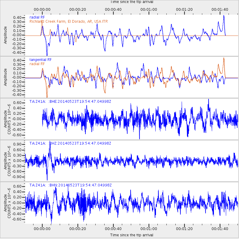
Signal To Noise
| Channel | StoN | STA | LTA |
| TA:Z41A: :BHZ:20140523T19:54:47.04998Z | 3.0815468 | 4.167284E-7 | 1.352335E-7 |
| TA:Z41A: :BHN:20140523T19:54:47.04998Z | 1.3709127 | 1.989621E-7 | 1.4513112E-7 |
| TA:Z41A: :BHE:20140523T19:54:47.04998Z | 0.7883968 | 1.3390628E-7 | 1.698463E-7 |
| Arrivals |
| Ps | |
| PpPs | |
| PsPs/PpSs | |


