KURK Kurchatov, Kazakhstan - Earthquake Result Viewer
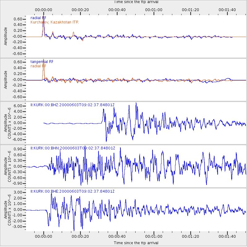
Earthquake location: Near East Coast Of Honshu, Japan
Earthquake latitude/longitude: 35.6/140.5
Earthquake time(UTC): 2000/06/03 (155) 08:54:49 GMT
Earthquake Depth: 62 km
Earthquake Magnitude: 5.6 MB, 5.6 MS, 6.1 MW, 6.1 MW
Earthquake Catalog/Contributor: WHDF/NEIC
Network: II Global Seismograph Network (GSN - IRIS/IDA)
Station: KURK Kurchatov, Kazakhstan
Lat/Lon: 50.72 N/78.62 E
Elevation: 184 m
Distance: 46.3 deg
Az: 309.119 deg
Baz: 84.362 deg
Ray Param: 0.070581734
Estimated Moho Depth: 41.5 km
Estimated Crust Vp/Vs: 1.73
Assumed Crust Vp: 6.552 km/s
Estimated Crust Vs: 3.788 km/s
Estimated Crust Poisson's Ratio: 0.25
Radial Match: 97.619896 %
Radial Bump: 400
Transverse Match: 80.24571 %
Transverse Bump: 400
SOD ConfigId: 3744
Insert Time: 2010-03-01 22:31:42.813 +0000
GWidth: 2.5
Max Bumps: 400
Tol: 0.001

Signal To Noise

ChannelStoNSTALTA
II:KURK:00:BHN:20000603T09:02:37.84801Z2.70577361.1852156E-74.3803208E-8
II:KURK:00:BHE:20000603T09:02:37.84801Z43.393651.2679266E-62.9219171E-8
II:KURK:00:BHZ:20000603T09:02:37.84801Z28.3993382.526646E-68.896849E-8
Arrivals
Ps4.9 SECOND
PpPs16 SECOND
PsPs/PpSs21 SECOND