You are here: Home > Network List > UW - Pacific Northwest Regional Seismic Network Stations List
> Station MRBL Marblemount, WA, USA > Earthquake Result Viewer
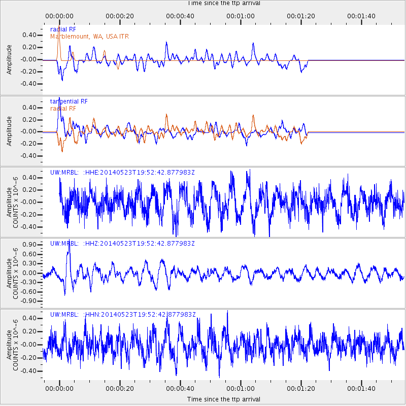
MRBL Marblemount, WA, USA - Earthquake Result Viewer
*The percent match for this event was below the threshold and hence no stack was calculated.
| Earthquake location: |
East Of Lake Baykal, Russia |
| Earthquake latitude/longitude: |
56.1/114.0 |
| Earthquake time(UTC): |
2014/05/23 (143) 19:42:28 GMT |
| Earthquake Depth: |
10 km |
| Earthquake Magnitude: |
5.6 MB |
| Earthquake Catalog/Contributor: |
NEIC PDE/NEIC COMCAT |
|
| Network: |
UW Pacific Northwest Regional Seismic Network |
| Station: |
MRBL Marblemount, WA, USA |
| Lat/Lon: |
48.52 N/121.48 W |
| Elevation: |
75 m |
|
| Distance: |
65.9 deg |
| Az: |
36.872 deg |
| Baz: |
329.66 deg |
| Ray Param: |
$rayparam |
*The percent match for this event was below the threshold and hence was not used in the summary stack. |
|
| Radial Match: |
76.770134 % |
| Radial Bump: |
400 |
| Transverse Match: |
74.61793 % |
| Transverse Bump: |
400 |
| SOD ConfigId: |
626651 |
| Insert Time: |
2014-06-06 21:04:36.836 +0000 |
| GWidth: |
2.5 |
| Max Bumps: |
400 |
| Tol: |
0.001 |
|
Signal To Noise
| Channel | StoN | STA | LTA |
| UW:MRBL: :HHZ:20140523T19:52:42.877983Z | 4.447743 | 4.2833577E-7 | 9.630407E-8 |
| UW:MRBL: :HHN:20140523T19:52:42.877983Z | 0.919047 | 1.5200209E-7 | 1.6539097E-7 |
| UW:MRBL: :HHE:20140523T19:52:42.877983Z | 1.265585 | 1.9270274E-7 | 1.5226378E-7 |
| Arrivals |
| Ps | |
| PpPs | |
| PsPs/PpSs | |


