KURK Kurchatov, Kazakhstan - Earthquake Result Viewer
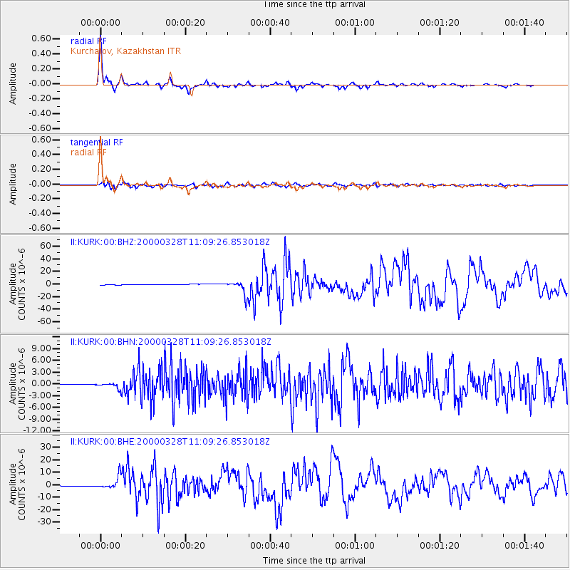
Earthquake location: Volcano Islands, Japan Region
Earthquake latitude/longitude: 22.3/143.7
Earthquake time(UTC): 2000/03/28 (088) 11:00:22 GMT
Earthquake Depth: 126 km
Earthquake Magnitude: 6.8 MB, 7.6 MS, 7.6 MW, 7.6 MW
Earthquake Catalog/Contributor: WHDF/NEIC
Network: II Global Seismograph Network (GSN - IRIS/IDA)
Station: KURK Kurchatov, Kazakhstan
Lat/Lon: 50.72 N/78.62 E
Elevation: 184 m
Distance: 57.4 deg
Az: 316.776 deg
Baz: 94.125 deg
Ray Param: 0.063160665
Estimated Moho Depth: 41.25 km
Estimated Crust Vp/Vs: 1.72
Assumed Crust Vp: 6.552 km/s
Estimated Crust Vs: 3.815 km/s
Estimated Crust Poisson's Ratio: 0.24
Radial Match: 97.95107 %
Radial Bump: 227
Transverse Match: 91.583275 %
Transverse Bump: 400
SOD ConfigId: 3744
Insert Time: 2010-03-01 22:31:52.856 +0000
GWidth: 2.5
Max Bumps: 400
Tol: 0.001

Signal To Noise

ChannelStoNSTALTA
II:KURK:00:BHN:20000328T11:09:26.853018Z18.4463257.3325043E-73.9750486E-8
II:KURK:00:BHE:20000328T11:09:26.853018Z19.2097995.0331314E-62.6200854E-7
II:KURK:00:BHZ:20000328T11:09:26.853018Z28.111671.1432007E-54.066641E-7
Arrivals
Ps4.8 SECOND
PpPs16 SECOND
PsPs/PpSs21 SECOND