You are here: Home > Network List > TA - USArray Transportable Network (new EarthScope stations) Stations List
> Station G59A Clarenceville, QC, USA > Earthquake Result Viewer
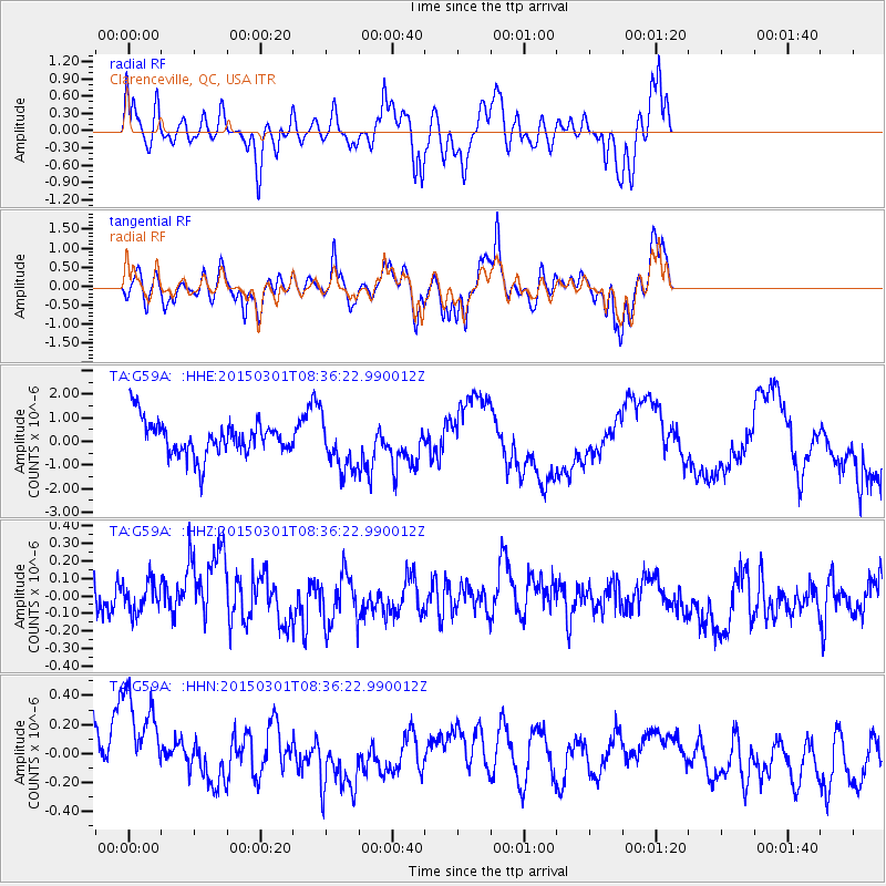
G59A Clarenceville, QC, USA - Earthquake Result Viewer
*The percent match for this event was below the threshold and hence no stack was calculated.
| Earthquake location: |
Near Coast Of Guatemala |
| Earthquake latitude/longitude: |
13.4/-91.0 |
| Earthquake time(UTC): |
2015/03/01 (060) 08:30:03 GMT |
| Earthquake Depth: |
20 km |
| Earthquake Magnitude: |
5.5 MWW, 5.2 MWB, 5.5 MWC |
| Earthquake Catalog/Contributor: |
NEIC PDE/NEIC COMCAT |
|
| Network: |
TA USArray Transportable Network (new EarthScope stations) |
| Station: |
G59A Clarenceville, QC, USA |
| Lat/Lon: |
45.08 N/73.18 W |
| Elevation: |
36 m |
|
| Distance: |
35.0 deg |
| Az: |
22.212 deg |
| Baz: |
211.276 deg |
| Ray Param: |
$rayparam |
*The percent match for this event was below the threshold and hence was not used in the summary stack. |
|
| Radial Match: |
64.77018 % |
| Radial Bump: |
390 |
| Transverse Match: |
59.15674 % |
| Transverse Bump: |
400 |
| SOD ConfigId: |
7019011 |
| Insert Time: |
2019-04-17 03:51:31.168 +0000 |
| GWidth: |
2.5 |
| Max Bumps: |
400 |
| Tol: |
0.001 |
|
Signal To Noise
| Channel | StoN | STA | LTA |
| TA:G59A: :HHZ:20150301T08:36:22.990012Z | 0.5772766 | 1.6071678E-7 | 2.7840514E-7 |
| TA:G59A: :HHN:20150301T08:36:22.990012Z | 1.4389554 | 5.1317943E-7 | 3.5663334E-7 |
| TA:G59A: :HHE:20150301T08:36:22.990012Z | 1.5573803 | 1.1210014E-6 | 7.197994E-7 |
| Arrivals |
| Ps | |
| PpPs | |
| PsPs/PpSs | |


