You are here: Home > Network List > TA - USArray Transportable Network (new EarthScope stations) Stations List
> Station L04D Klamath Falls, OR, USA > Earthquake Result Viewer
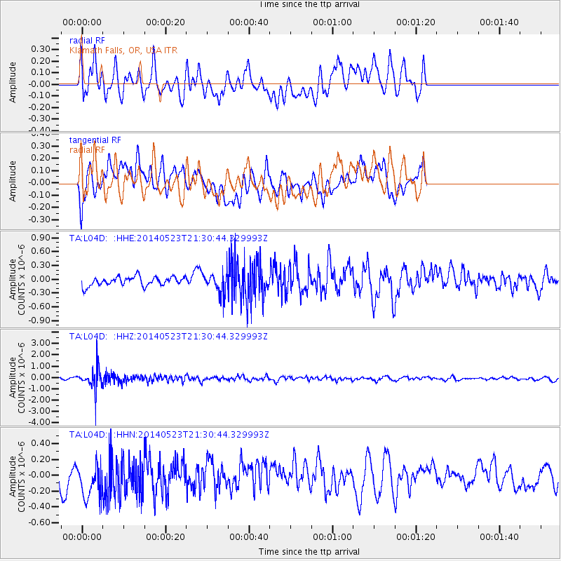
L04D Klamath Falls, OR, USA - Earthquake Result Viewer
*The percent match for this event was below the threshold and hence no stack was calculated.
| Earthquake location: |
Mariana Islands |
| Earthquake latitude/longitude: |
19.0/145.0 |
| Earthquake time(UTC): |
2014/05/23 (143) 21:20:06 GMT |
| Earthquake Depth: |
558 km |
| Earthquake Magnitude: |
5.5 M |
| Earthquake Catalog/Contributor: |
NEIC PDE/NEIC ALERT |
|
| Network: |
TA USArray Transportable Network (new EarthScope stations) |
| Station: |
L04D Klamath Falls, OR, USA |
| Lat/Lon: |
42.22 N/122.30 W |
| Elevation: |
1437 m |
|
| Distance: |
79.4 deg |
| Az: |
49.018 deg |
| Baz: |
285.913 deg |
| Ray Param: |
$rayparam |
*The percent match for this event was below the threshold and hence was not used in the summary stack. |
|
| Radial Match: |
46.007782 % |
| Radial Bump: |
400 |
| Transverse Match: |
51.450806 % |
| Transverse Bump: |
400 |
| SOD ConfigId: |
626651 |
| Insert Time: |
2014-06-06 21:47:56.688 +0000 |
| GWidth: |
2.5 |
| Max Bumps: |
400 |
| Tol: |
0.001 |
|
Signal To Noise
| Channel | StoN | STA | LTA |
| TA:L04D: :HHZ:20140523T21:30:44.329993Z | 6.8676343 | 9.269101E-7 | 1.3496789E-7 |
| TA:L04D: :HHN:20140523T21:30:44.329993Z | 1.1682776 | 2.5654325E-7 | 2.1959099E-7 |
| TA:L04D: :HHE:20140523T21:30:44.329993Z | 2.3403516 | 2.3004013E-7 | 9.8292986E-8 |
| Arrivals |
| Ps | |
| PpPs | |
| PsPs/PpSs | |


