You are here: Home > Network List > IU - Global Seismograph Network (GSN - IRIS/USGS) Stations List
> Station JOHN Johnston Island, USA > Earthquake Result Viewer
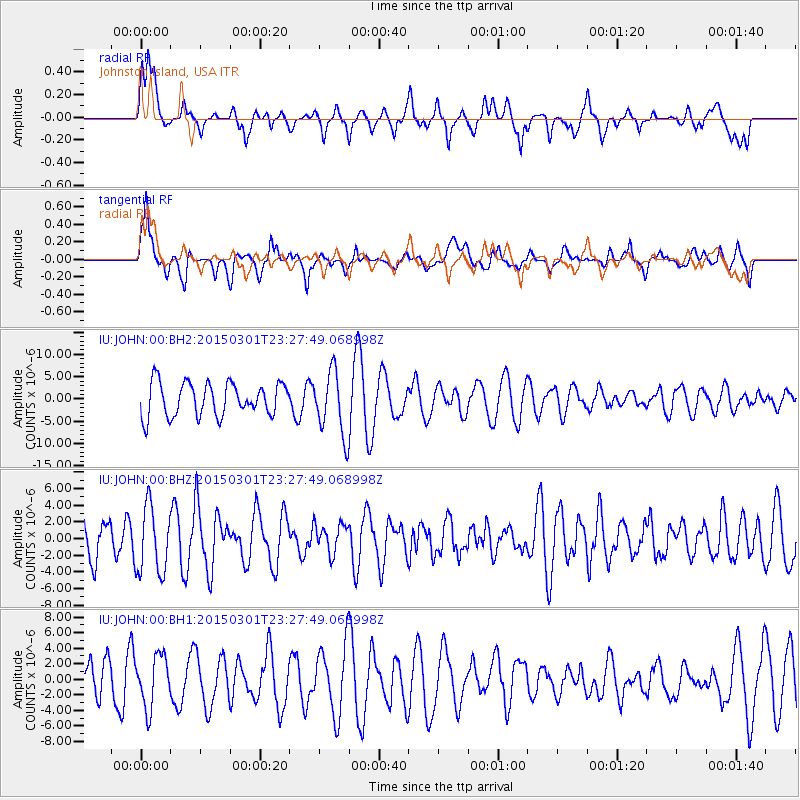
JOHN Johnston Island, USA - Earthquake Result Viewer
*The percent match for this event was below the threshold and hence no stack was calculated.
| Earthquake location: |
South Of Kermadec Islands |
| Earthquake latitude/longitude: |
-33.5/-179.3 |
| Earthquake time(UTC): |
2015/03/01 (060) 23:19:22 GMT |
| Earthquake Depth: |
35 km |
| Earthquake Magnitude: |
4.7 mb |
| Earthquake Catalog/Contributor: |
ISC/ISC |
|
| Network: |
IU Global Seismograph Network (GSN - IRIS/USGS) |
| Station: |
JOHN Johnston Island, USA |
| Lat/Lon: |
16.73 N/169.53 W |
| Elevation: |
2.0 m |
|
| Distance: |
50.8 deg |
| Az: |
12.141 deg |
| Baz: |
190.574 deg |
| Ray Param: |
$rayparam |
*The percent match for this event was below the threshold and hence was not used in the summary stack. |
|
| Radial Match: |
55.668606 % |
| Radial Bump: |
400 |
| Transverse Match: |
56.835434 % |
| Transverse Bump: |
400 |
| SOD ConfigId: |
7019011 |
| Insert Time: |
2019-04-17 04:01:30.119 +0000 |
| GWidth: |
2.5 |
| Max Bumps: |
400 |
| Tol: |
0.001 |
|
Signal To Noise
| Channel | StoN | STA | LTA |
| IU:JOHN:00:BHZ:20150301T23:27:49.068998Z | 1.5621974 | 4.000953E-6 | 2.561106E-6 |
| IU:JOHN:00:BH1:20150301T23:27:49.068998Z | 1.423781 | 3.2989178E-6 | 2.317012E-6 |
| IU:JOHN:00:BH2:20150301T23:27:49.068998Z | 1.9309037 | 7.1805075E-6 | 3.718729E-6 |
| Arrivals |
| Ps | |
| PpPs | |
| PsPs/PpSs | |


