You are here: Home > Network List > US - United States National Seismic Network Stations List
> Station HAWA Hanford, Washington, USA > Earthquake Result Viewer
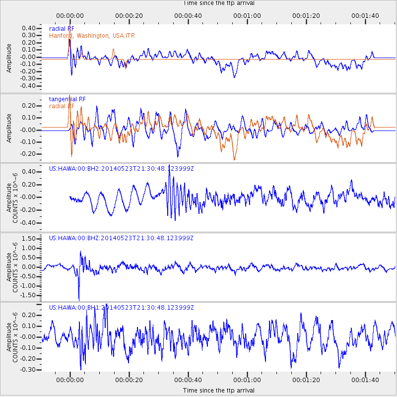
HAWA Hanford, Washington, USA - Earthquake Result Viewer
*The percent match for this event was below the threshold and hence no stack was calculated.
| Earthquake location: |
Mariana Islands |
| Earthquake latitude/longitude: |
19.0/145.0 |
| Earthquake time(UTC): |
2014/05/23 (143) 21:20:06 GMT |
| Earthquake Depth: |
558 km |
| Earthquake Magnitude: |
5.5 M |
| Earthquake Catalog/Contributor: |
NEIC PDE/NEIC ALERT |
|
| Network: |
US United States National Seismic Network |
| Station: |
HAWA Hanford, Washington, USA |
| Lat/Lon: |
46.39 N/119.53 W |
| Elevation: |
364 m |
|
| Distance: |
80.1 deg |
| Az: |
44.378 deg |
| Baz: |
287.019 deg |
| Ray Param: |
$rayparam |
*The percent match for this event was below the threshold and hence was not used in the summary stack. |
|
| Radial Match: |
38.51122 % |
| Radial Bump: |
400 |
| Transverse Match: |
62.030087 % |
| Transverse Bump: |
400 |
| SOD ConfigId: |
626651 |
| Insert Time: |
2014-06-06 21:50:06.723 +0000 |
| GWidth: |
2.5 |
| Max Bumps: |
400 |
| Tol: |
0.001 |
|
Signal To Noise
| Channel | StoN | STA | LTA |
| US:HAWA:00:BHZ:20140523T21:30:48.123999Z | 3.240883 | 4.2417608E-7 | 1.3088287E-7 |
| US:HAWA:00:BH1:20140523T21:30:48.123999Z | 1.5093259 | 9.755881E-8 | 6.463734E-8 |
| US:HAWA:00:BH2:20140523T21:30:48.123999Z | 1.7381853 | 1.9774286E-7 | 1.13763974E-7 |
| Arrivals |
| Ps | |
| PpPs | |
| PsPs/PpSs | |


