You are here: Home > Network List > TA - USArray Transportable Network (new EarthScope stations) Stations List
> Station J01E Myrtle Point, OR, USA > Earthquake Result Viewer
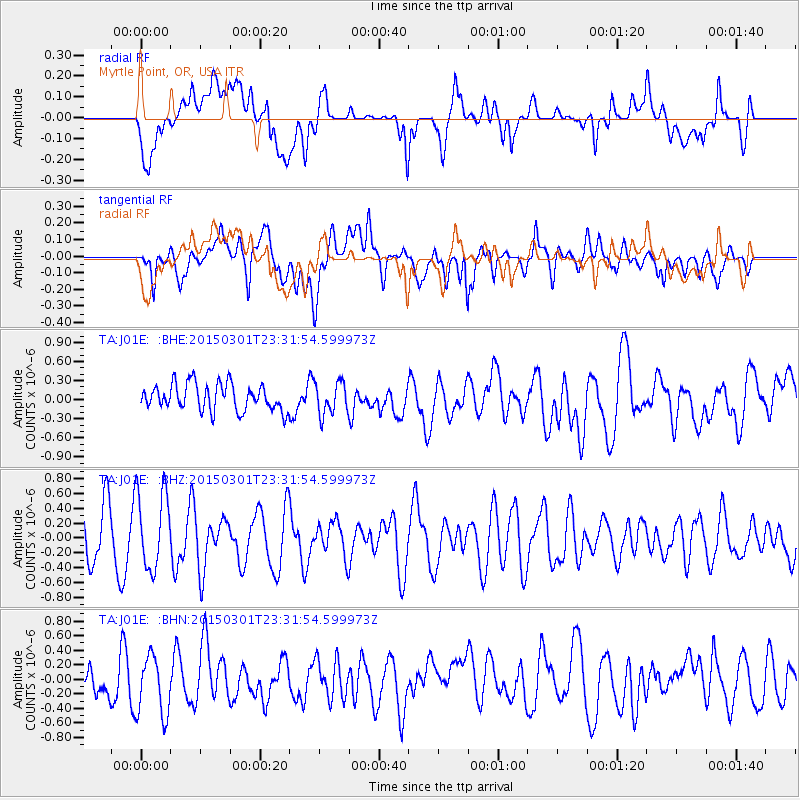
J01E Myrtle Point, OR, USA - Earthquake Result Viewer
*The percent match for this event was below the threshold and hence no stack was calculated.
| Earthquake location: |
South Of Kermadec Islands |
| Earthquake latitude/longitude: |
-33.5/-179.3 |
| Earthquake time(UTC): |
2015/03/01 (060) 23:19:22 GMT |
| Earthquake Depth: |
35 km |
| Earthquake Magnitude: |
4.7 mb |
| Earthquake Catalog/Contributor: |
ISC/ISC |
|
| Network: |
TA USArray Transportable Network (new EarthScope stations) |
| Station: |
J01E Myrtle Point, OR, USA |
| Lat/Lon: |
43.16 N/123.93 W |
| Elevation: |
128 m |
|
| Distance: |
91.5 deg |
| Az: |
37.044 deg |
| Baz: |
223.494 deg |
| Ray Param: |
$rayparam |
*The percent match for this event was below the threshold and hence was not used in the summary stack. |
|
| Radial Match: |
42.779434 % |
| Radial Bump: |
400 |
| Transverse Match: |
64.195564 % |
| Transverse Bump: |
400 |
| SOD ConfigId: |
7019011 |
| Insert Time: |
2019-04-17 04:02:18.044 +0000 |
| GWidth: |
2.5 |
| Max Bumps: |
400 |
| Tol: |
0.001 |
|
Signal To Noise
| Channel | StoN | STA | LTA |
| TA:J01E: :BHZ:20150301T23:31:54.599973Z | 1.4970347 | 5.255355E-7 | 3.5105097E-7 |
| TA:J01E: :BHN:20150301T23:31:54.599973Z | 2.4066315 | 4.2424773E-7 | 1.762828E-7 |
| TA:J01E: :BHE:20150301T23:31:54.599973Z | 1.2269928 | 2.542037E-7 | 2.0717619E-7 |
| Arrivals |
| Ps | |
| PpPs | |
| PsPs/PpSs | |


