You are here: Home > Network List > US - United States National Seismic Network Stations List
> Station MNTX Cornudas Mountains, Texas, USA > Earthquake Result Viewer
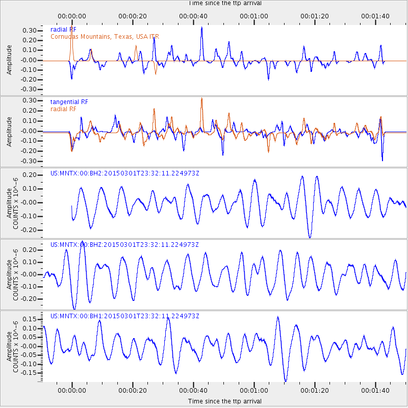
MNTX Cornudas Mountains, Texas, USA - Earthquake Result Viewer
*The percent match for this event was below the threshold and hence no stack was calculated.
| Earthquake location: |
South Of Kermadec Islands |
| Earthquake latitude/longitude: |
-33.5/-179.3 |
| Earthquake time(UTC): |
2015/03/01 (060) 23:19:22 GMT |
| Earthquake Depth: |
35 km |
| Earthquake Magnitude: |
4.7 mb |
| Earthquake Catalog/Contributor: |
ISC/ISC |
|
| Network: |
US United States National Seismic Network |
| Station: |
MNTX Cornudas Mountains, Texas, USA |
| Lat/Lon: |
31.70 N/105.38 W |
| Elevation: |
404 m |
|
| Distance: |
95.1 deg |
| Az: |
55.329 deg |
| Baz: |
233.767 deg |
| Ray Param: |
$rayparam |
*The percent match for this event was below the threshold and hence was not used in the summary stack. |
|
| Radial Match: |
55.032593 % |
| Radial Bump: |
353 |
| Transverse Match: |
43.470303 % |
| Transverse Bump: |
400 |
| SOD ConfigId: |
7019011 |
| Insert Time: |
2019-04-17 04:02:47.793 +0000 |
| GWidth: |
2.5 |
| Max Bumps: |
400 |
| Tol: |
0.001 |
|
Signal To Noise
| Channel | StoN | STA | LTA |
| US:MNTX:00:BHZ:20150301T23:32:11.224973Z | 2.5937693 | 1.9327777E-7 | 7.451618E-8 |
| US:MNTX:00:BH1:20150301T23:32:11.224973Z | 0.48016512 | 3.28553E-8 | 6.8425E-8 |
| US:MNTX:00:BH2:20150301T23:32:11.224973Z | 0.47049108 | 3.6440838E-8 | 7.7452775E-8 |
| Arrivals |
| Ps | |
| PpPs | |
| PsPs/PpSs | |


