You are here: Home > Network List > UW - Pacific Northwest Regional Seismic Network Stations List
> Station LEBA Lebam, WA, USA > Earthquake Result Viewer
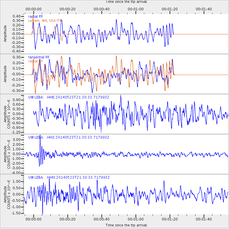
LEBA Lebam, WA, USA - Earthquake Result Viewer
*The percent match for this event was below the threshold and hence no stack was calculated.
| Earthquake location: |
Mariana Islands |
| Earthquake latitude/longitude: |
19.0/145.0 |
| Earthquake time(UTC): |
2014/05/23 (143) 21:20:06 GMT |
| Earthquake Depth: |
558 km |
| Earthquake Magnitude: |
5.5 M |
| Earthquake Catalog/Contributor: |
NEIC PDE/NEIC ALERT |
|
| Network: |
UW Pacific Northwest Regional Seismic Network |
| Station: |
LEBA Lebam, WA, USA |
| Lat/Lon: |
46.55 N/123.56 W |
| Elevation: |
73 m |
|
| Distance: |
77.4 deg |
| Az: |
44.992 deg |
| Baz: |
284.226 deg |
| Ray Param: |
$rayparam |
*The percent match for this event was below the threshold and hence was not used in the summary stack. |
|
| Radial Match: |
55.6813 % |
| Radial Bump: |
363 |
| Transverse Match: |
45.118984 % |
| Transverse Bump: |
400 |
| SOD ConfigId: |
626651 |
| Insert Time: |
2014-06-06 21:53:49.139 +0000 |
| GWidth: |
2.5 |
| Max Bumps: |
400 |
| Tol: |
0.001 |
|
Signal To Noise
| Channel | StoN | STA | LTA |
| UW:LEBA: :HHZ:20140523T21:30:33.717993Z | 5.506534 | 1.1060366E-6 | 2.0085896E-7 |
| UW:LEBA: :HHN:20140523T21:30:33.717993Z | 1.3849518 | 4.65005E-7 | 3.3575537E-7 |
| UW:LEBA: :HHE:20140523T21:30:33.717993Z | 1.4754391 | 4.8760995E-7 | 3.304846E-7 |
| Arrivals |
| Ps | |
| PpPs | |
| PsPs/PpSs | |


