You are here: Home > Network List > US - United States National Seismic Network Stations List
> Station EGMT Eagleton, Montana, USA > Earthquake Result Viewer
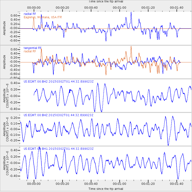
EGMT Eagleton, Montana, USA - Earthquake Result Viewer
*The percent match for this event was below the threshold and hence no stack was calculated.
| Earthquake location: |
Kuril Islands |
| Earthquake latitude/longitude: |
45.3/150.0 |
| Earthquake time(UTC): |
2015/03/02 (061) 01:34:42 GMT |
| Earthquake Depth: |
100 km |
| Earthquake Magnitude: |
4.1 mb |
| Earthquake Catalog/Contributor: |
ISC/ISC |
|
| Network: |
US United States National Seismic Network |
| Station: |
EGMT Eagleton, Montana, USA |
| Lat/Lon: |
48.02 N/109.75 W |
| Elevation: |
1055 m |
|
| Distance: |
63.8 deg |
| Az: |
47.426 deg |
| Baz: |
309.32 deg |
| Ray Param: |
$rayparam |
*The percent match for this event was below the threshold and hence was not used in the summary stack. |
|
| Radial Match: |
51.461384 % |
| Radial Bump: |
400 |
| Transverse Match: |
42.481594 % |
| Transverse Bump: |
400 |
| SOD ConfigId: |
7019011 |
| Insert Time: |
2019-04-17 04:11:46.415 +0000 |
| GWidth: |
2.5 |
| Max Bumps: |
400 |
| Tol: |
0.001 |
|
Signal To Noise
| Channel | StoN | STA | LTA |
| US:EGMT:00:BHZ:20150302T01:44:32.899023Z | 0.5389057 | 5.3825648E-8 | 9.9879536E-8 |
| US:EGMT:00:BH1:20150302T01:44:32.899023Z | 1.9460981 | 3.37033E-7 | 1.7318398E-7 |
| US:EGMT:00:BH2:20150302T01:44:32.899023Z | 1.3060352 | 2.0427565E-7 | 1.56409E-7 |
| Arrivals |
| Ps | |
| PpPs | |
| PsPs/PpSs | |


