You are here: Home > Network List > IU - Global Seismograph Network (GSN - IRIS/USGS) Stations List
> Station RSSD Black Hills, South Dakota, USA > Earthquake Result Viewer
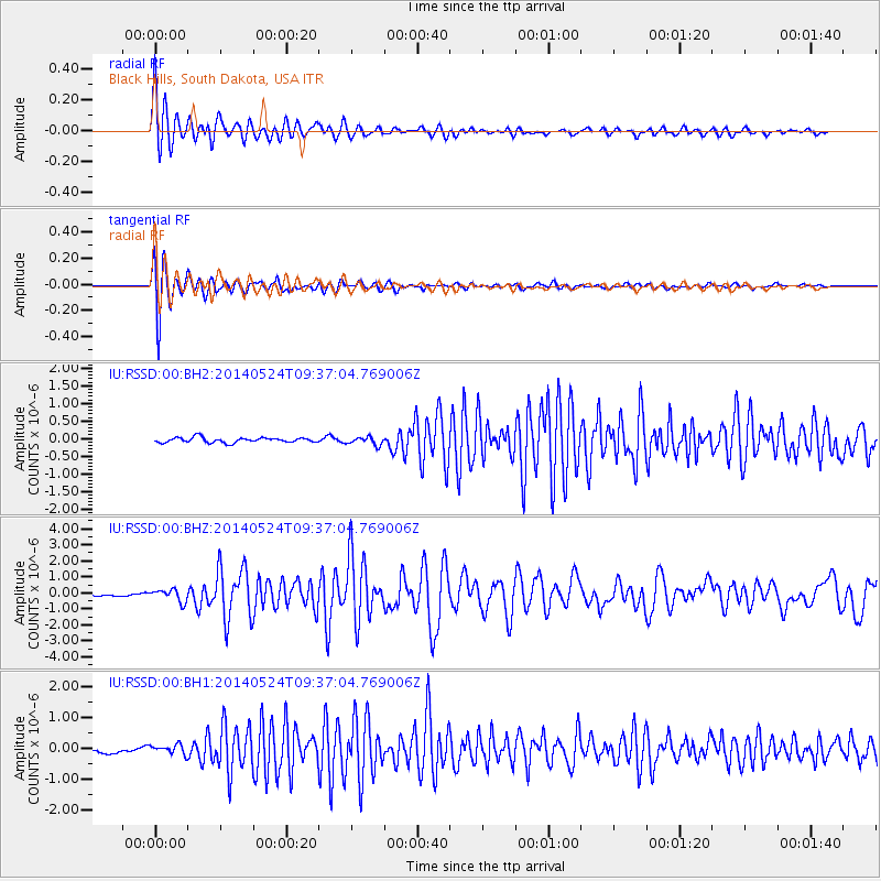
RSSD Black Hills, South Dakota, USA - Earthquake Result Viewer
*The percent match for this event was below the threshold and hence no stack was calculated.
| Earthquake location: |
Aegean Sea |
| Earthquake latitude/longitude: |
40.3/25.5 |
| Earthquake time(UTC): |
2014/05/24 (144) 09:25:03 GMT |
| Earthquake Depth: |
10 km |
| Earthquake Magnitude: |
6.4 MWP, 6.4 M |
| Earthquake Catalog/Contributor: |
NEIC PDE/NEIC ALERT |
|
| Network: |
IU Global Seismograph Network (GSN - IRIS/USGS) |
| Station: |
RSSD Black Hills, South Dakota, USA |
| Lat/Lon: |
44.12 N/104.04 W |
| Elevation: |
2090 m |
|
| Distance: |
84.4 deg |
| Az: |
326.052 deg |
| Baz: |
36.364 deg |
| Ray Param: |
$rayparam |
*The percent match for this event was below the threshold and hence was not used in the summary stack. |
|
| Radial Match: |
94.50407 % |
| Radial Bump: |
400 |
| Transverse Match: |
96.03322 % |
| Transverse Bump: |
400 |
| SOD ConfigId: |
626651 |
| Insert Time: |
2014-06-07 09:47:35.888 +0000 |
| GWidth: |
2.5 |
| Max Bumps: |
400 |
| Tol: |
0.001 |
|
Signal To Noise
| Channel | StoN | STA | LTA |
| IU:RSSD:00:BHZ:20140524T09:37:04.769006Z | 5.093359 | 3.8939336E-7 | 7.6451194E-8 |
| IU:RSSD:00:BH1:20140524T09:37:04.769006Z | 2.4531572 | 1.5225558E-7 | 6.2065155E-8 |
| IU:RSSD:00:BH2:20140524T09:37:04.769006Z | 1.6020468 | 1.1342974E-7 | 7.080301E-8 |
| Arrivals |
| Ps | |
| PpPs | |
| PsPs/PpSs | |


