You are here: Home > Network List > II - Global Seismograph Network (GSN - IRIS/IDA) Stations List
> Station KURK Kurchatov, Kazakhstan > Earthquake Result Viewer
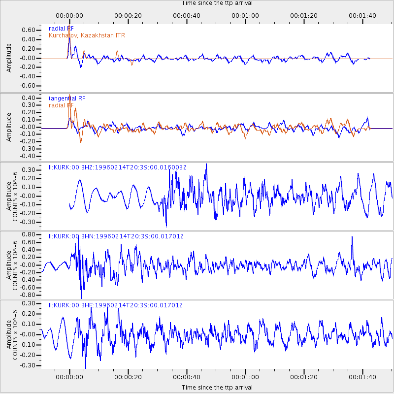
KURK Kurchatov, Kazakhstan - Earthquake Result Viewer
*The percent match for this event was below the threshold and hence no stack was calculated.
| Earthquake location: |
Kuril Islands |
| Earthquake latitude/longitude: |
45.4/150.4 |
| Earthquake time(UTC): |
1996/02/14 (045) 20:31:06 GMT |
| Earthquake Depth: |
33 km |
| Earthquake Magnitude: |
5.9 MB, 5.2 MS, 5.8 UNKNOWN, 5.8 MW |
| Earthquake Catalog/Contributor: |
WHDF/NEIC |
|
| Network: |
II Global Seismograph Network (GSN - IRIS/IDA) |
| Station: |
KURK Kurchatov, Kazakhstan |
| Lat/Lon: |
50.72 N/78.62 E |
| Elevation: |
184 m |
|
| Distance: |
46.5 deg |
| Az: |
303.702 deg |
| Baz: |
67.253 deg |
| Ray Param: |
$rayparam |
*The percent match for this event was below the threshold and hence was not used in the summary stack. |
|
| Radial Match: |
69.874084 % |
| Radial Bump: |
400 |
| Transverse Match: |
42.076107 % |
| Transverse Bump: |
392 |
| SOD ConfigId: |
4480 |
| Insert Time: |
2010-03-01 22:34:26.395 +0000 |
| GWidth: |
2.5 |
| Max Bumps: |
400 |
| Tol: |
0.001 |
|
Signal To Noise
| Channel | StoN | STA | LTA |
| II:KURK:00:BHN:19960214T20:39:00.01701Z | 3.9042552 | 3.284157E-7 | 8.4117374E-8 |
| II:KURK:00:BHE:19960214T20:39:00.01701Z | 1.0279468 | 1.2790325E-7 | 1.2442594E-7 |
| II:KURK:00:BHZ:19960214T20:39:00.016003Z | 1.4390943 | 1.2764269E-7 | 8.8696545E-8 |
| Arrivals |
| Ps | |
| PpPs | |
| PsPs/PpSs | |


