You are here: Home > Network List > II - Global Seismograph Network (GSN - IRIS/IDA) Stations List
> Station KURK Kurchatov, Kazakhstan > Earthquake Result Viewer
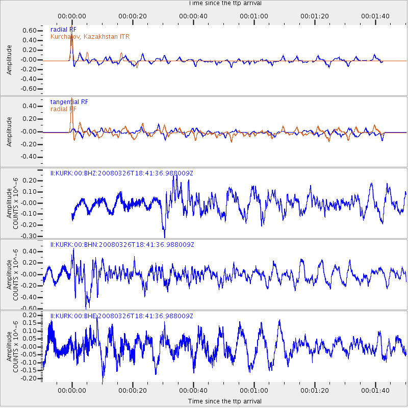
KURK Kurchatov, Kazakhstan - Earthquake Result Viewer
*The percent match for this event was below the threshold and hence no stack was calculated.
| Earthquake location: |
Kuril Islands |
| Earthquake latitude/longitude: |
46.4/153.0 |
| Earthquake time(UTC): |
2008/03/26 (086) 18:33:34 GMT |
| Earthquake Depth: |
17 km |
| Earthquake Magnitude: |
5.5 MB, 5.2 MS, 5.6 MW, 5.5 MW |
| Earthquake Catalog/Contributor: |
WHDF/NEIC |
|
| Network: |
II Global Seismograph Network (GSN - IRIS/IDA) |
| Station: |
KURK Kurchatov, Kazakhstan |
| Lat/Lon: |
50.72 N/78.62 E |
| Elevation: |
184 m |
|
| Distance: |
47.5 deg |
| Az: |
303.821 deg |
| Baz: |
64.679 deg |
| Ray Param: |
$rayparam |
*The percent match for this event was below the threshold and hence was not used in the summary stack. |
|
| Radial Match: |
53.946617 % |
| Radial Bump: |
347 |
| Transverse Match: |
60.38191 % |
| Transverse Bump: |
400 |
| SOD ConfigId: |
2504 |
| Insert Time: |
2010-03-01 22:34:30.374 +0000 |
| GWidth: |
2.5 |
| Max Bumps: |
400 |
| Tol: |
0.001 |
|
Signal To Noise
| Channel | StoN | STA | LTA |
| II:KURK:00:BHN:20080326T18:41:36.988009Z | 2.315048 | 2.2830324E-7 | 9.8617065E-8 |
| II:KURK:00:BHE:20080326T18:41:36.988009Z | 0.6611315 | 4.8225242E-8 | 7.294349E-8 |
| II:KURK:00:BHZ:20080326T18:41:36.988009Z | 3.175345 | 1.4809518E-7 | 4.6639084E-8 |
| Arrivals |
| Ps | |
| PpPs | |
| PsPs/PpSs | |


