You are here: Home > Network List > II - Global Seismograph Network (GSN - IRIS/IDA) Stations List
> Station ABKT Alibek, Turkmenistan > Earthquake Result Viewer
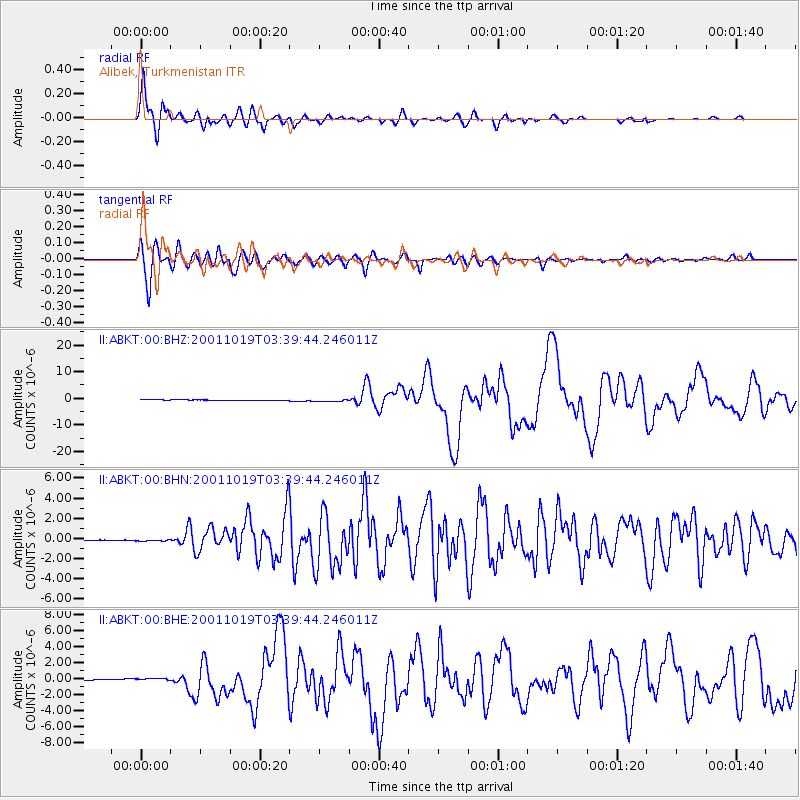
ABKT Alibek, Turkmenistan - Earthquake Result Viewer

| Earthquake location: |
Banda Sea |
| Earthquake latitude/longitude: |
-4.1/123.9 |
| Earthquake time(UTC): |
2001/10/19 (292) 03:28:44 GMT |
| Earthquake Depth: |
33 km |
| Earthquake Magnitude: |
6.3 MB, 7.3 MS, 7.5 MW, 7.4 MW |
| Earthquake Catalog/Contributor: |
WHDF/NEIC |
|
| Network: |
II Global Seismograph Network (GSN - IRIS/IDA) |
| Station: |
ABKT Alibek, Turkmenistan |
| Lat/Lon: |
37.93 N/58.12 E |
| Elevation: |
678 m |
|
| Distance: |
73.7 deg |
| Az: |
311.302 deg |
| Baz: |
108.625 deg |
| Ray Param: |
0.052753743 |
| Estimated Moho Depth: |
43.5 km |
| Estimated Crust Vp/Vs: |
1.60 |
| Assumed Crust Vp: |
6.53 km/s |
| Estimated Crust Vs: |
4.082 km/s |
| Estimated Crust Poisson's Ratio: |
0.18 |
|
| Radial Match: |
95.48682 % |
| Radial Bump: |
400 |
| Transverse Match: |
93.511795 % |
| Transverse Bump: |
400 |
| SOD ConfigId: |
20082 |
| Insert Time: |
2010-03-01 22:37:47.754 +0000 |
| GWidth: |
2.5 |
| Max Bumps: |
400 |
| Tol: |
0.001 |
|
Signal To Noise
| Channel | StoN | STA | LTA |
| II:ABKT:00:BHN:20011019T03:39:44.246011Z | 3.9386265 | 9.6802104E-8 | 2.457763E-8 |
| II:ABKT:00:BHE:20011019T03:39:44.246011Z | 2.9241393 | 2.0070037E-7 | 6.863571E-8 |
| II:ABKT:00:BHZ:20011019T03:39:44.246011Z | 3.3940792 | 5.203333E-7 | 1.5330616E-7 |
| Arrivals |
| Ps | 4.2 SECOND |
| PpPs | 17 SECOND |
| PsPs/PpSs | 21 SECOND |


