ABKT Alibek, Turkmenistan - Earthquake Result Viewer
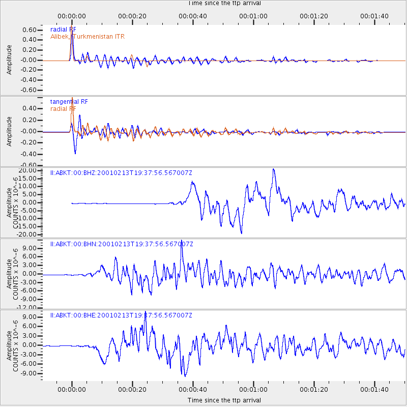
Earthquake location: Southern Sumatra, Indonesia
Earthquake latitude/longitude: -4.7/102.6
Earthquake time(UTC): 2001/02/13 (044) 19:28:30 GMT
Earthquake Depth: 36 km
Earthquake Magnitude: 6.2 MB, 7.2 MS, 7.4 MW, 7.0 ME
Earthquake Catalog/Contributor: WHDF/NEIC
Network: II Global Seismograph Network (GSN - IRIS/IDA)
Station: ABKT Alibek, Turkmenistan
Lat/Lon: 37.93 N/58.12 E
Elevation: 678 m
Distance: 59.1 deg
Az: 319.829 deg
Baz: 125.602 deg
Ray Param: 0.06232539
Estimated Moho Depth: 35.5 km
Estimated Crust Vp/Vs: 1.93
Assumed Crust Vp: 6.53 km/s
Estimated Crust Vs: 3.388 km/s
Estimated Crust Poisson's Ratio: 0.32
Radial Match: 96.81165 %
Radial Bump: 400
Transverse Match: 93.23013 %
Transverse Bump: 400
SOD ConfigId: 3744
Insert Time: 2010-03-01 22:38:16.244 +0000
GWidth: 2.5
Max Bumps: 400
Tol: 0.001

Signal To Noise

ChannelStoNSTALTA
II:ABKT:00:BHN:20010213T19:37:56.567007Z2.84198571.705603E-76.001448E-8
II:ABKT:00:BHE:20010213T19:37:56.567007Z1.13951628.653869E-87.5943355E-8
II:ABKT:00:BHZ:20010213T19:37:56.567007Z2.98882273.190191E-71.0673738E-7
Arrivals
Ps5.3 SECOND
PpPs15 SECOND
PsPs/PpSs20 SECOND