You are here: Home > Network List > TA - USArray Transportable Network (new EarthScope stations) Stations List
> Station 121A Cookes Peak, Deming, NM, USA > Earthquake Result Viewer
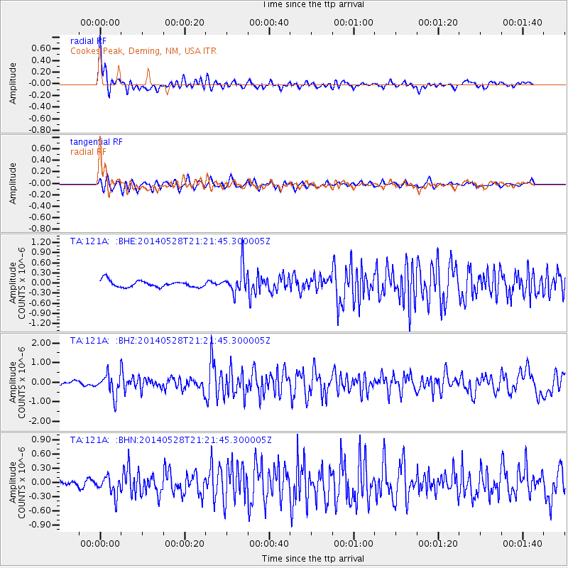
121A Cookes Peak, Deming, NM, USA - Earthquake Result Viewer
*The percent match for this event was below the threshold and hence no stack was calculated.
| Earthquake location: |
Mona Passage |
| Earthquake latitude/longitude: |
18.1/-68.4 |
| Earthquake time(UTC): |
2014/05/28 (148) 21:15:04 GMT |
| Earthquake Depth: |
91 km |
| Earthquake Magnitude: |
5.8 MWW, 5.3 MI, 5.9 MWR |
| Earthquake Catalog/Contributor: |
NEIC PDE/NEIC COMCAT |
|
| Network: |
TA USArray Transportable Network (new EarthScope stations) |
| Station: |
121A Cookes Peak, Deming, NM, USA |
| Lat/Lon: |
32.53 N/107.79 W |
| Elevation: |
1652 m |
|
| Distance: |
38.2 deg |
| Az: |
299.788 deg |
| Baz: |
102.308 deg |
| Ray Param: |
$rayparam |
*The percent match for this event was below the threshold and hence was not used in the summary stack. |
|
| Radial Match: |
79.768005 % |
| Radial Bump: |
400 |
| Transverse Match: |
70.235016 % |
| Transverse Bump: |
400 |
| SOD ConfigId: |
626651 |
| Insert Time: |
2014-06-11 21:43:41.280 +0000 |
| GWidth: |
2.5 |
| Max Bumps: |
400 |
| Tol: |
0.001 |
|
Signal To Noise
| Channel | StoN | STA | LTA |
| TA:121A: :BHZ:20140528T21:21:45.300005Z | 4.9363275 | 5.591776E-7 | 1.13278055E-7 |
| TA:121A: :BHN:20140528T21:21:45.300005Z | 1.8709167 | 2.0506701E-7 | 1.0960777E-7 |
| TA:121A: :BHE:20140528T21:21:45.300005Z | 4.0743265 | 3.9504826E-7 | 9.696038E-8 |
| Arrivals |
| Ps | |
| PpPs | |
| PsPs/PpSs | |


