You are here: Home > Network List > TA - USArray Transportable Network (new EarthScope stations) Stations List
> Station R11A Troy Canyon, Currant, NV, USA > Earthquake Result Viewer
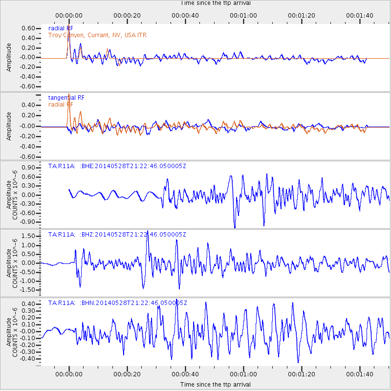
R11A Troy Canyon, Currant, NV, USA - Earthquake Result Viewer
*The percent match for this event was below the threshold and hence no stack was calculated.
| Earthquake location: |
Mona Passage |
| Earthquake latitude/longitude: |
18.1/-68.4 |
| Earthquake time(UTC): |
2014/05/28 (148) 21:15:04 GMT |
| Earthquake Depth: |
91 km |
| Earthquake Magnitude: |
5.8 MWW, 5.3 MI, 5.9 MWR |
| Earthquake Catalog/Contributor: |
NEIC PDE/NEIC COMCAT |
|
| Network: |
TA USArray Transportable Network (new EarthScope stations) |
| Station: |
R11A Troy Canyon, Currant, NV, USA |
| Lat/Lon: |
38.35 N/115.59 W |
| Elevation: |
1756 m |
|
| Distance: |
45.7 deg |
| Az: |
306.197 deg |
| Baz: |
102.575 deg |
| Ray Param: |
$rayparam |
*The percent match for this event was below the threshold and hence was not used in the summary stack. |
|
| Radial Match: |
74.14257 % |
| Radial Bump: |
400 |
| Transverse Match: |
74.612885 % |
| Transverse Bump: |
400 |
| SOD ConfigId: |
626651 |
| Insert Time: |
2014-06-11 21:46:38.247 +0000 |
| GWidth: |
2.5 |
| Max Bumps: |
400 |
| Tol: |
0.001 |
|
Signal To Noise
| Channel | StoN | STA | LTA |
| TA:R11A: :BHZ:20140528T21:22:46.050005Z | 6.266784 | 4.8806555E-7 | 7.7881346E-8 |
| TA:R11A: :BHN:20140528T21:22:46.050005Z | 0.95710534 | 7.601482E-8 | 7.942158E-8 |
| TA:R11A: :BHE:20140528T21:22:46.050005Z | 2.7031248 | 2.2819152E-7 | 8.4417685E-8 |
| Arrivals |
| Ps | |
| PpPs | |
| PsPs/PpSs | |


