You are here: Home > Network List > UW - Pacific Northwest Regional Seismic Network Stations List
> Station MRBL Marblemount, WA, USA > Earthquake Result Viewer
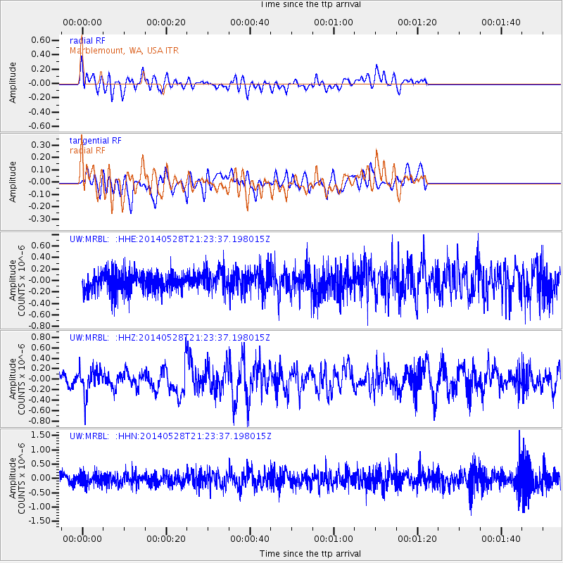
MRBL Marblemount, WA, USA - Earthquake Result Viewer
*The percent match for this event was below the threshold and hence no stack was calculated.
| Earthquake location: |
Mona Passage |
| Earthquake latitude/longitude: |
18.1/-68.4 |
| Earthquake time(UTC): |
2014/05/28 (148) 21:15:04 GMT |
| Earthquake Depth: |
91 km |
| Earthquake Magnitude: |
5.8 MWW, 5.3 MI, 5.9 MWR |
| Earthquake Catalog/Contributor: |
NEIC PDE/NEIC COMCAT |
|
| Network: |
UW Pacific Northwest Regional Seismic Network |
| Station: |
MRBL Marblemount, WA, USA |
| Lat/Lon: |
48.52 N/121.48 W |
| Elevation: |
75 m |
|
| Distance: |
52.4 deg |
| Az: |
317.814 deg |
| Baz: |
106.162 deg |
| Ray Param: |
$rayparam |
*The percent match for this event was below the threshold and hence was not used in the summary stack. |
|
| Radial Match: |
61.42972 % |
| Radial Bump: |
400 |
| Transverse Match: |
57.893536 % |
| Transverse Bump: |
400 |
| SOD ConfigId: |
626651 |
| Insert Time: |
2014-06-11 21:52:19.279 +0000 |
| GWidth: |
2.5 |
| Max Bumps: |
400 |
| Tol: |
0.001 |
|
Signal To Noise
| Channel | StoN | STA | LTA |
| UW:MRBL: :HHZ:20140528T21:23:37.198015Z | 2.3481774 | 2.4790273E-7 | 1.05572404E-7 |
| UW:MRBL: :HHN:20140528T21:23:37.198015Z | 1.3260357 | 2.0749037E-7 | 1.5647419E-7 |
| UW:MRBL: :HHE:20140528T21:23:37.198015Z | 1.1637778 | 2.0014062E-7 | 1.7197493E-7 |
| Arrivals |
| Ps | |
| PpPs | |
| PsPs/PpSs | |


