You are here: Home > Network List > AK - Alaska Regional Network Stations List
> Station MDM Murphy Dome > Earthquake Result Viewer
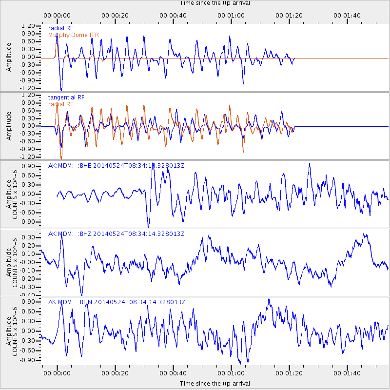
MDM Murphy Dome - Earthquake Result Viewer
*The percent match for this event was below the threshold and hence no stack was calculated.
| Earthquake location: |
Near Coast Of Guerrero, Mexico |
| Earthquake latitude/longitude: |
16.5/-98.1 |
| Earthquake time(UTC): |
2014/05/24 (144) 08:24:47 GMT |
| Earthquake Depth: |
17 km |
| Earthquake Magnitude: |
5.7 MWW, 5.6 MWB, 5.7 MWC |
| Earthquake Catalog/Contributor: |
NEIC PDE/NEIC COMCAT |
|
| Network: |
AK Alaska Regional Network |
| Station: |
MDM Murphy Dome |
| Lat/Lon: |
64.96 N/148.23 W |
| Elevation: |
634 m |
|
| Distance: |
58.8 deg |
| Az: |
337.568 deg |
| Baz: |
120.685 deg |
| Ray Param: |
$rayparam |
*The percent match for this event was below the threshold and hence was not used in the summary stack. |
|
| Radial Match: |
55.23458 % |
| Radial Bump: |
400 |
| Transverse Match: |
51.05316 % |
| Transverse Bump: |
400 |
| SOD ConfigId: |
626651 |
| Insert Time: |
2014-06-12 09:38:52.058 +0000 |
| GWidth: |
2.5 |
| Max Bumps: |
400 |
| Tol: |
0.001 |
|
Signal To Noise
| Channel | StoN | STA | LTA |
| AK:MDM: :BHZ:20140524T08:34:14.328013Z | 1.3561611 | 2.098875E-7 | 1.5476591E-7 |
| AK:MDM: :BHN:20140524T08:34:14.328013Z | 3.3930087 | 4.798792E-7 | 1.4143177E-7 |
| AK:MDM: :BHE:20140524T08:34:14.328013Z | 5.5111794 | 5.666832E-7 | 1.028243E-7 |
| Arrivals |
| Ps | |
| PpPs | |
| PsPs/PpSs | |


