
ABKT Alibek, Turkmenistan - Earthquake Result Viewer
| ||||||||||||||||||
| ||||||||||||||||||
| ||||||||||||||||||
|
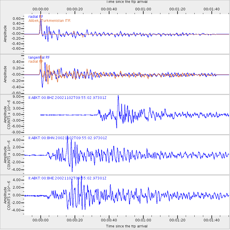
Signal To Noise
| Channel | StoN | STA | LTA |
| II:ABKT:00:BHN:20021102T09:55:02.97301Z | 6.147613 | 2.7281482E-7 | 4.4377355E-8 |
| II:ABKT:00:BHE:20021102T09:55:02.97301Z | 5.3116946 | 2.2841401E-7 | 4.3002096E-8 |
| II:ABKT:00:BHZ:20021102T09:55:02.97301Z | 14.784977 | 7.9094394E-7 | 5.349646E-8 |
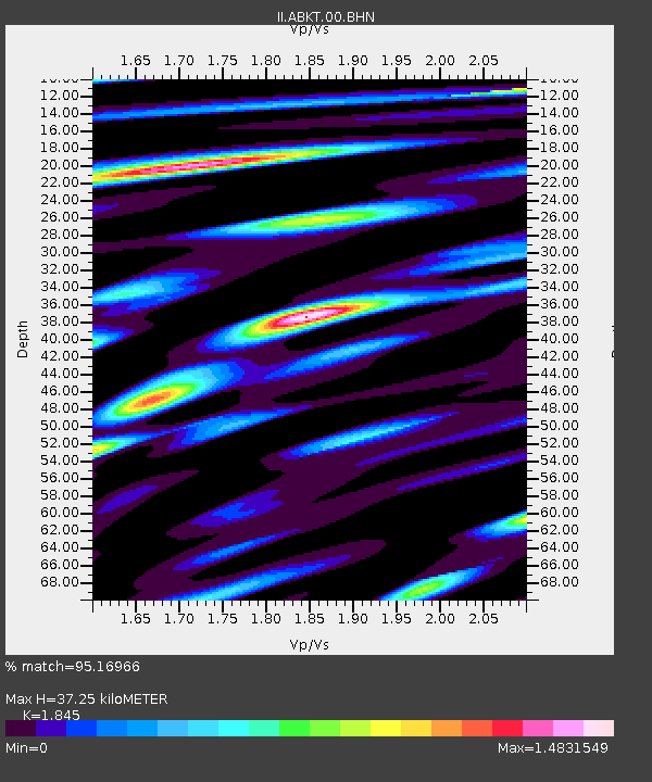
| Arrivals | |
| Ps | 5.1 SECOND |
| PpPs | 15 SECOND |
| PsPs/PpSs | 20 SECOND |

