You are here: Home > Network List > G - GEOSCOPE Stations List
> Station MPG Montagne des Peres, French Guyana > Earthquake Result Viewer
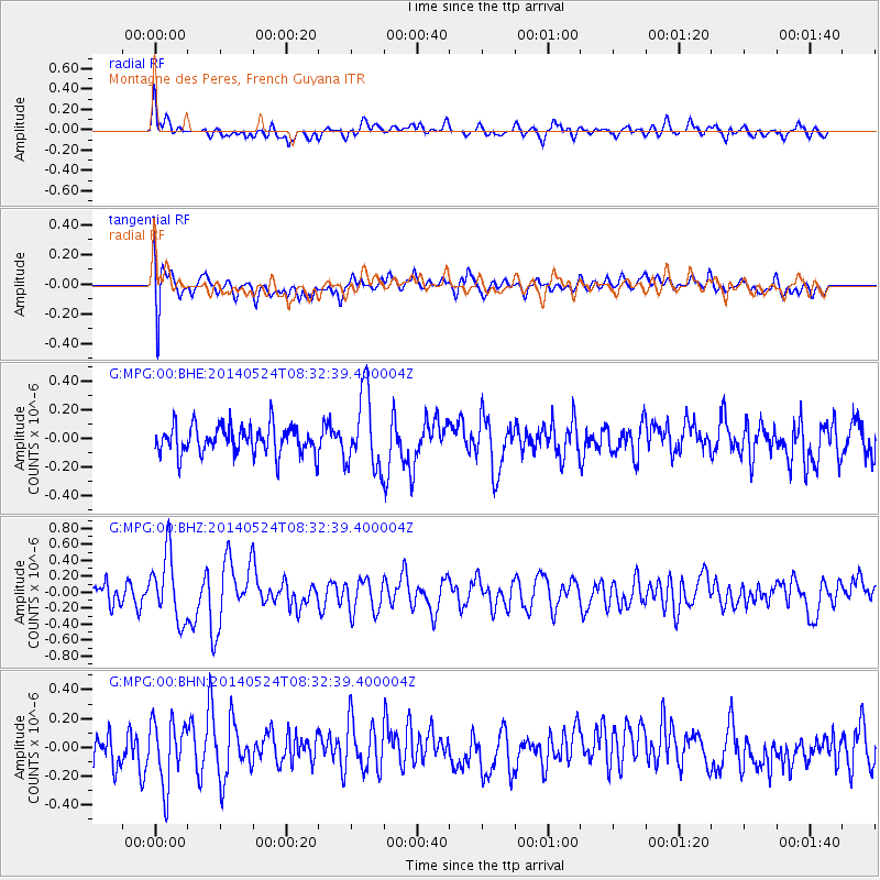
MPG Montagne des Peres, French Guyana - Earthquake Result Viewer
*The percent match for this event was below the threshold and hence no stack was calculated.
| Earthquake location: |
Near Coast Of Guerrero, Mexico |
| Earthquake latitude/longitude: |
16.5/-98.1 |
| Earthquake time(UTC): |
2014/05/24 (144) 08:24:47 GMT |
| Earthquake Depth: |
17 km |
| Earthquake Magnitude: |
5.7 MWW, 5.6 MWB, 5.7 MWC |
| Earthquake Catalog/Contributor: |
NEIC PDE/NEIC COMCAT |
|
| Network: |
G GEOSCOPE |
| Station: |
MPG Montagne des Peres, French Guyana |
| Lat/Lon: |
5.11 N/52.64 W |
| Elevation: |
147 m |
|
| Distance: |
46.0 deg |
| Az: |
98.999 deg |
| Baz: |
287.986 deg |
| Ray Param: |
$rayparam |
*The percent match for this event was below the threshold and hence was not used in the summary stack. |
|
| Radial Match: |
60.56344 % |
| Radial Bump: |
400 |
| Transverse Match: |
66.75982 % |
| Transverse Bump: |
400 |
| SOD ConfigId: |
626651 |
| Insert Time: |
2014-06-12 09:47:14.040 +0000 |
| GWidth: |
2.5 |
| Max Bumps: |
400 |
| Tol: |
0.001 |
|
Signal To Noise
| Channel | StoN | STA | LTA |
| G:MPG:00:BHZ:20140524T08:32:39.400004Z | 2.2620404 | 4.1257414E-7 | 1.8239027E-7 |
| G:MPG:00:BHN:20140524T08:32:39.400004Z | 1.6554669 | 2.1898215E-7 | 1.3227817E-7 |
| G:MPG:00:BHE:20140524T08:32:39.400004Z | 2.6553993 | 2.6362014E-7 | 9.9277024E-8 |
| Arrivals |
| Ps | |
| PpPs | |
| PsPs/PpSs | |


